No one here says it should be this way. But honestly since I moved to Taipei I have not seen a shred of evidence that the area would be developed otherwise.
Songshan Airport not a “novelty.” Tokyo has one of these things (Haneda), Seoul has one (Gimpo), and so does Shanghai. You could argue that these are vastly larger and more important cities than Taipei. But certainly by utilizing Songshan Airport in this way, Taipei is not embarking on some radical novel scheme.
Guy[/quote]
London also has a City airport for domestic and short-hall flights.
Like others say, dont trust powers that be with the space. Songshan Cultural Park just seems like a few restaurants, a massive Eslite and a pond.
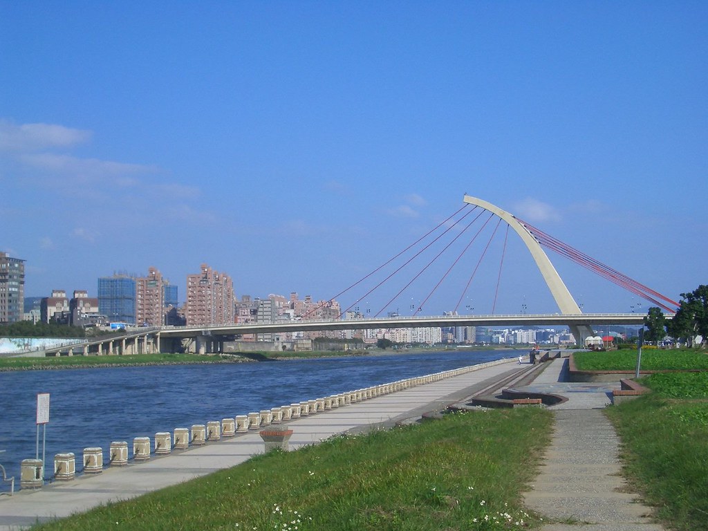
Songshan is a little unusual the way it’s smack bang in the middle of the city. I can where skepticism of a city park being put in place of the airport comes from…look at the Songshan ‘creative and cultural park’ as an example I guess of what would actually happen. That said, such an area may still be more enjoyable than an airport that is used rarely by working and middle class local citizens
Also I don’t think it has much value as an Air Force airport…it would be taken out by missiles very quickly in a conflict with china and probably have large collateral damage. But the likelihood of this eventuality seems very low at the moment.
[quote=“Hokwongwei”]I agree green space is a good thing, but I think Songshan is a bad choice for location. Look at how much green space is already there:
[/quote]
most of the green areas marked on the map are along the river and beyond the levees. Those “parks” are little more than glorified flood zones and as such will never be a healthy permanent wooded area. It will be, even at best weather, a field of dying grass. Besides, it’s much better to have a large piece of concentrated wooded area, than hundreds of tiny patches of trees all surrounded by concrete.
[quote=“tommy525”]Yeah Tokyo did not get rid of Haneda once Narita opened. Jakarta still has Halim even though Soekarno-Hatta opened and I believe K.Lumpur still has Subang. Seoul still has Kimpo, etc.
Nobody is getting rid of their inner city airports it seems.[/quote]
Haneda isn’t exactly inner city either. It’s like 20KMs away from downtown Tokyo. Where Songshan is like 5… Also Haneda is on an island.
Areas around Gimpo airport looks more rural than TPE.
You are all forgetting that many major airports like Heathrow and Hong Kong have their take off and approach routes directly over the cities they serve. Approach and take-off profiles of flight are low speed, high risk manouevering aspects of flight.
Songshan is technically safer to Taipei than Chep Lap Kok is to Hong Kong because aircraft don’t typically spend an large amount of time over urban areas. From the West aircraft typically spend about 1 minute over built up areas on a straight in approach, and on departure are typically away from all built up areas after about 1 minute.
Compared to Hong Kong or Heathrow where routing takes place as low as 3000 feet over urban areas, often with a series of turns and even holds, typically lasting 3 -5 minutes in very high intensity skies, Songshan is very low risk.
[quote=“Bernadette”]You are all forgetting that many major airports like Heathrow and Hong Kong have their take off and approach routes directly over the cities they serve. Approach and take-off profiles of flight are low speed, high risk manouevering aspects of flight.
Songshan is technically safer to Taipei than Chep Lap Kok is to Hong Kong because aircraft don’t typically spend an large amount of time over urban areas. From the West aircraft typically spend about 1 minute over built up areas on a straight in approach, and on departure are typically away from all built up areas after about 1 minute.
Compared to Hong Kong or Heathrow where routing takes place as low as 3000 feet over urban areas, often with a series of turns and even holds, typically lasting 3 -5 minutes in very high intensity skies, Songshan is very low risk.[/quote]
Hong Kong already moved from the old Kai Tak to the new Chek Lap Kok Airport a good distance away from the city. From the map it doesn’t seem like take off and landing at HKIA would fly over the city. Don’t think I flew over the city either on my many visa runs. Judging from the map, even if the planes taking off at Chep Kap Kok makes a turn into the more densely populated areas, it would be at a higher altitude than planes at Songshan when they fly over parts of the city.
Don’t know enough about Heathrow airport, only been there once.
Aircraft use procedural routes called SIDs and STARs (Standard Terminal Arrival Route and Standard Instrument Departure). These procedural routes dictate, according to where the aircraft is coming from, where it is going and the prevailing weather condition, how the aircraft arrives or departs at or from an airport. The aircraft automatically (usually) flies these precision routes. Several of Hong Kongs are routed directly over the city itself.
From what I can see, if your definition of “city” is the political definition, like “New Taipei City”, then it flies over Hong Kong city, otherwise it seems the route flies over Sa Tin and Kwai Chung, which aren’t exactly downtown.
That’s not a comprehensive diagram of all the procedural routes. You are by the way speaking to an ex-md11 pilot who used to fly into HKIA from time to time. On one the approaches over flies the airport itself. It then follows the suspension bridge and turns over the harbor. I’ll upload one later if I can copy one. I’m on my smartphone now.
I was just looking at FR24 as I was second guessing myself. If you have a look for a few minutes you can see the odd one overflying the city.
There’s not just one route in or out. The crew will ask for clearance and then select a preloaded FMC route for a SID or be given routing in prior to arrival, also drawn up from a preloaded STAR in the FMC. The aircraft will then follow that route down to establish the localizer and glidslope to the runway. Also, on different days you’ll get assigned different routes depending on which runways are in use.
[quote=“Bernadette”]I was just looking at FR24 as I was second guessing myself. If you have a look for a few minutes you can see the odd one overflying the city.
There’s not just one route in or out. The crew will ask for clearance and then select a preloaded FMC route for a SID or be given routing in prior to arrival, also drawn up from a preloaded STAR in the FMC. The aircraft will then follow that route down to establish the localizer and glidslope to the runway. Also, on different days you’ll get assigned different routes depending on which runways are in use.[/quote]
Most flights shown on FR24 seems to cut across the harbor and not over the city on either side. The flights that do are flying over 7000ft when they cut across the city. When GE235 lost contact over Taipei it was only over 1000ft and below 1500ft.
Oh, just seen your charts - they didn’t appear on my phone at the start, so thanks for those. These are ILS procedures which are slightly different to SID and STAR procedures. Theses approaches use VOR Transmitters and the crew then use these to position themselves, along with ATC to establish the ILS or deal with a missed approach. SID and STAR procedures still utilize ILS approaches, but the transition to the capture of the glidslope is different depending which STAR is used. For ILS approaches no FMC need be used, but for STAR and SID procrdures, an FMC and GPS is required.
Just figured it. Anything transitioning BEKOL will generally overfly Hong Kong, but you are correct that most of the traffic in and out of Hong Kong is routed over water.
Anyway, the position of HKIA means planes are at a much higher altitude even if they fly over downtown, which not all flights do. At Songshan, since it is located downtown, planes are flying over the city at a much lower altitude.
No one here says it should be this way. But honestly since I moved to Taipei I have not seen a shred of evidence that the area would be developed otherwise.
Songshan Airport not a “novelty.” Tokyo has one of these things (Haneda), Seoul has one (Gimpo), and so does Shanghai. You could argue that these are vastly larger and more important cities than Taipei. But certainly by utilizing Songshan Airport in this way, Taipei is not embarking on some radical novel scheme.
Guy[/quote]
shanghai does not. can’t comment on the other two i have not been there. but another poster has said they are not central.
I’ve flown through all of them multiple times. From my impression Songshan is the only one right in the centre of a major city. In that case, and as we saw recently very clearly, the chance for a very bad crash taking many lives on the ground would seem to be higher on take-off or landing. It was a miracle that the plane ended up in the river instead of crashing into a building given how densely populated Taipei is.