De’en is excellent. The son (who goes by the colorful name of Da4Tou2, or Big Head, is doing a master’s in ecotourism and is super knowledgeable about butterflies and other local critters. Go next month when the purple (who overwinter en masse in Maolin) are out in the thousands most every morning.
If you get a chance also talk to the son about his research into hunting culture.
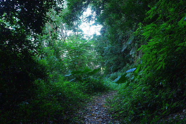
nice pic. whats the chinese name of that lovers gorge? before morakot there was another water that was absolutely fabulous, thought its under a few meters of rock now We live on the edge of the scenic area towards the southern edge, if you are ever in the area im always up for a scooter ride into the hills
I think it is Cingren Valley but I don’t have the characters (yet). Meiya waterfall is considered inaccessible but I’ve hiked part of the way in the riverbed and want to check it out again. I didn’t know at the time where Meiya waterfall was but I think it was around the next bend. Of course it could also be broken up. There was also a big storm in the area and it occurred to me that a riverbed would be an awful place to be hiking at that time. The trail was completely washed out.
I’m planning to go back up into the hills around Sandimen sometime. I know that you can get to LiangShan waterfall and I think there are a lot of waterfalls in the area.
Well, if you are out and about, i live right next to Sandimen and know some of the waterfalls here, though not by name. Also some construction happening out past Majia, and the last waterfall on that road before the big slide has been raped by the construction workers…it used to be a favorite midnight skinny spot, but now aint so pretty
Lots of nice pics of waterfalls, but not much on hiking and camping. Maybe it’s time to add a report for people who might ‘search’ hiking and end up at this thread!
For anyone who lives in or near Taichung County, Guguan and the nearby BaShianshan Forest Recreation Reserve are quite well-known. At the last village before GuGuan, there is a turn-off to a trail that climbs up over a peak at about 1700 meters and continues on and joins the DaSyueShan Forestry Road at the 31km point.
A few weeks ago when the weather forecast didn’t look so good on the east side, I decided to explore this area that I had bypassed last time after doing the Snow Mtn west route further in. When I arrived at the trail head there was a sign board saying that the military sometimes used this trail for training exercises and that explained the van with a bin full of discarded lunch boxes and two large water containers that I raided to top up my dromedary bag. Strike 1. I looked around wondering if this was an ambush but no one was around.The trail was steep but well-used and on arriving at a flat point I noticed on the other side of the rise a group of soldiers listening attentively to an officer’s lecture. Their backs were to me, so I walked quietly by and they didn’t notice. Strike 2 to Lynnie!
The path took a while after crossing a small stream to hit the ridge and there were some ropes installed on some steep bits. The path had a few jungle jim climbing frames and concrete-lined fox holes but I think the military do most of their training - orienteering exercises and so on - off the path. I met only one party who were on their way down and as dusk crept in through the tree cover I came upon an open-sided shelter about half an hour before the peak. I camped there and it was just at the right altitude for flying squirrel.
The next morning, as I continued up I saw a Swinhoe’s Pheasant, which in its confusion continued running along the path the last sight of him being his white tail disappearing into the underbrush.The peak had a fair amount of tree cover but there were views down valley.Near the peak was an unmarked trail going down a different way to the No.8 Hwy. At the end of the trail I came out on to the road near the 31km point. I turned left and walked to the 29km point where there is a steep untagged path up to the ridge line that overshadows the DaSyueShan Forestry Road. Eventually, I arrived at ShaoLaiShan at 2,307 meters. At the peak is a renovated fire lookout that rises about three storeys and gives views all the way back to the plains and to the south east a view of the ridgeline on the other side of the Central Cross-Island Hwy culminating in BaiGuDaShan.I stayed there in the cabin without any water worries because the rain run off goes down to a water barrel.
At dawn I packed up and had breakfast - a health bar and a kiwi fruit - and strolled down the path where it briefly joins the road at the 35km point. I felt glad that with the water up there, I didn’t choose to camp near the car park. The path soon reappears a little further up the road and although this stretch seems to be mostly secondary forest there were some nice grassy stretches where the path contoured around some minor peaks.The main peak is AnMaShan at 2,666 meters which I reached at about mid-day. From there there is a small concrete road that goes down 2km from the weather station to the visitor center at the 50 km point. That turned out to be perfect timing as the canteen there was open and I joined the road workers there for a bowl of rice, pork and ferns with bamboo shoot soup.
I spent a further two days further in on one of the forestry roads before hitching back down to near the 30 km point to hike again to the fire lookout on a different path than previously. If you go there watch out for the weasel that will move in on anything edible if you turn your back!
Another meal of mashed potato with tinned fish washed down with hot chocolate fortified me for the next days destination: YuanZueishan.This was about another hour to the west and the last bit of the ridge I hadn’t done. This peak is pretty famous as the rocky rugged granite ‘beak peak’ affords those with the time and energy an incomparably open view of LiShan and Snow Mountain and the lower part of the now closed Central Cross. There were quite a few people coming up the opposite way but I’d already cleared the roped sections before any potential traffic jams. While picking my footholds along the granite blocks, I thought back to a news story from about a year ago when some foreigners got lost up here and a bunch had to stay there overnight. I guess they didn’t have flashlights and left it too late because the path and the rope supports make the trail quite clear down to the main entrance at the 27 km point.
After 5 days of hiking and camping in cool clear weather, and after walking on the very quiet road from the trail head to the 20km point I got a ride to Fengyuan Train Station from two kind souls who also gave me a couple of persimmon to snack on.
[quote=“Jah Lynnie”]Lots of nice pics of waterfalls, but not much on hiking and camping. Maybe it’s time to add a report for people who might ‘search’ hiking and end up at this thread!
[/quote]
Usually the waterfalls are on a hiking trail so I don’t really understand your comment. If my schedule allowed I would love to get out for a big hike but for now it’s just afternoons and an occasional overnight. Nice trip and it will be easy to find the info now.
No worries. When I get time, I’ll post about overnight trips that might be of general interest (not too hardcore), so people can see what Taiwan has to offer in this field.
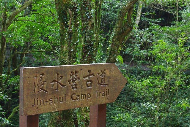
I’m not sure when I’ll get a chance for a legit backpacking trip but it might be awhile. I’m building up to a bike, hike and roadside camping CNY trip. Here’s a dayhike on the JinShui Trail (east of Pingdong) last weekend. I did it with Mark Roche’s Blue Skies Adventure group. He sets up some good trips in southern Taiwan.
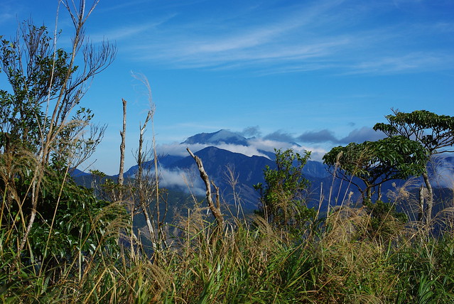
Cool. I’m going to be doing that trail next month. There’s a big butterfly valley at the end of the trail where it hits the river. Want to camp out and explore.
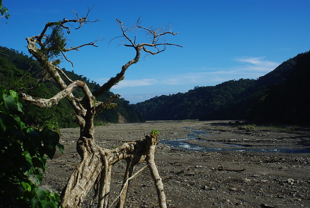
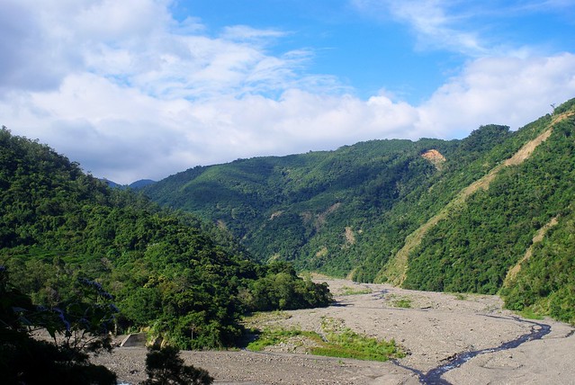
Do you still need to hike the last bit on the riverbed?
Can someone tell me directions to get to the Maolin butterfly migration? We found the area and saw some signs, but some roads were out, we then drove by a garbage truck sort and gave up after that as it was flooded. I really want to see this place seen as we are only a 30 min scooter ride away, Or am I now too late?
I do see lots of areas around these mountains that get lots of butterfly “orgies?” but not a full on migration which sounds really fascinating.
[quote=“Pingdong”]Can someone tell me directions to get to the Maolin butterfly migration? We found the area and saw some signs, but some roads were out, we then drove by a garbage truck sort and gave up after that as it was flooded. I really want to see this place seen as we are only a 30 min scooter ride away, Or am I now too late?
I do see lots of areas around these mountains that get lots of butterfly “orgies?” but not a full on migration which sounds really fascinating.[/quote]
The migration doesn’t happen in Maolin. That’s where they overwinter (actually one of 15 or so valleys where they overwinter). The best time to see the butterflies en masse is around 9-11am when it is sunny. The best month is January. You can see them roadside coming down from the big circle near the village. There are signs but not every day is great.
There are of course lots of remote locations where they swarm in greater numbers (Maolin is actually the least populated valley according to the experts). But you need a guide. I am planning a overnight hike into one of the deeper valleys in january with a local aboriginal guy as our guide.
There is another valley near Wanluan off the 185. It’s supposed to have signs to it now. I want to check that out this winter as this region was the prime purple butterfly research area in the 90s until the professor who covered it died. it’s only recently been “rediscovered”. Another prime location is at the end of the Jinshuiyin Historic Trail where the trail ends at that suspension bridge.
The migration happens in spring and you can see it in Linnei township at a point under the highway. But it’s hard to see the big swarms as we have no idea when they will decide to pass through. One day you might see a few dozen pass. The next day could see thousands a minute. I’ve only seen the former but it was still cool.
Btw, I was out in your area over the weekend. Would have contacted you but had a busy schedule checking out the conditions up to Shanping and Tengzhi with a friend.
[quote=“Mucha Man”]Cool. I’m going to be doing that trail next month. There’s a big butterfly valley at the end of the trail where it hits the river. Want to camp out and explore.
Do you still need to hike the last bit on the riverbed?[/quote]
Trucks will be able to cross the stream currently but it might be risky in cars. it looks like you can arrange blue truck style transport from the locals though. We walked to our van though.
Pingdong - Deen Gorge Guesthouse had a few recommendations for winter purple butterflies. Here is a link to their facebook photo album with a Maolin map. He recommended two spots near the village of Maolin. I think you should be able to see this on facebook. Otherwise he drew me a copy that I have somewhere. facebook.com/media/set/?set … 801&type=3
the Exif and camera/lens info is available on my flickr (linked in my sig). The basics Pentax K200D (10MP DSLR) - 3 yrs old. I typically use a variety of 24-50mm primes. All of them are old manual focus Pentax lenses from the 70’s-90’s until a month ago when I got a new lens. Normally I use a 2 or 3 stop ND filter and a polarizer at min aperture to get a 0.5-3s shutter speed (tripod obviously). Any other basic questions?
the Exif and camera/lens info is available on my flickr (linked in my sig). The basics Pentax K200D (10MP DSLR) - 3 yrs old. I typically use a variety of 24-50mm primes. All of them are old manual focus Pentax lenses from the 70’s-90’s until a month ago when I got a new lens. Normally I use a 2 or 3 stop ND filter and a polarizer at min aperture to get a 0.5-3s shutter speed (tripod obviously). Any other basic questions?[/quote]
 We live on the edge of the scenic area towards the southern edge, if you are ever in the area im always up for a scooter ride into the hills