Well done! :bravo: I’ve wanted to ride that road for a long time. I did the part up to Yulao several years ago and camped on the summit, but I’ve never done the road to Baling.
My Sunday ride was fantastic as well. About 3/4 of it was on roads I’d never ridden before, which doesn’t happen to me often. I started from the Miaoli train station and took the 6 out of town, through Gongguan and up the Houlong River to Highway 3 in Shitan. Despite being a provincial highway, the 6 was a very nice road, great for casual weekend cycling. At the end of it there was a village called Wenshui (汶水) with a typical “old street”.

I rode down through Dahu into Zhuolan before realizing I had overshot my road. “Oh well,” I thought, “at least now it’s late enough for me to have lunch in Dahu and get some food in my system before starting to climb.”
The Hakka restaurant I ate at was across from a beautiful temple whose name I’ve unfortunately forgotten. I asked the owner about the Miao 61 to Syuejian/Xuejian (雪見), the road I intended to ride, and she said it was closed after Erbensong (二本松). According to an article posted in the restaurant, the Xuejian road had only just opened in 2008.

I’d like to go up there sometime once it reopens. Apparently it’s called Xuejian because in the winter you can see snow on Snow Mountain and the Holy Ridge.
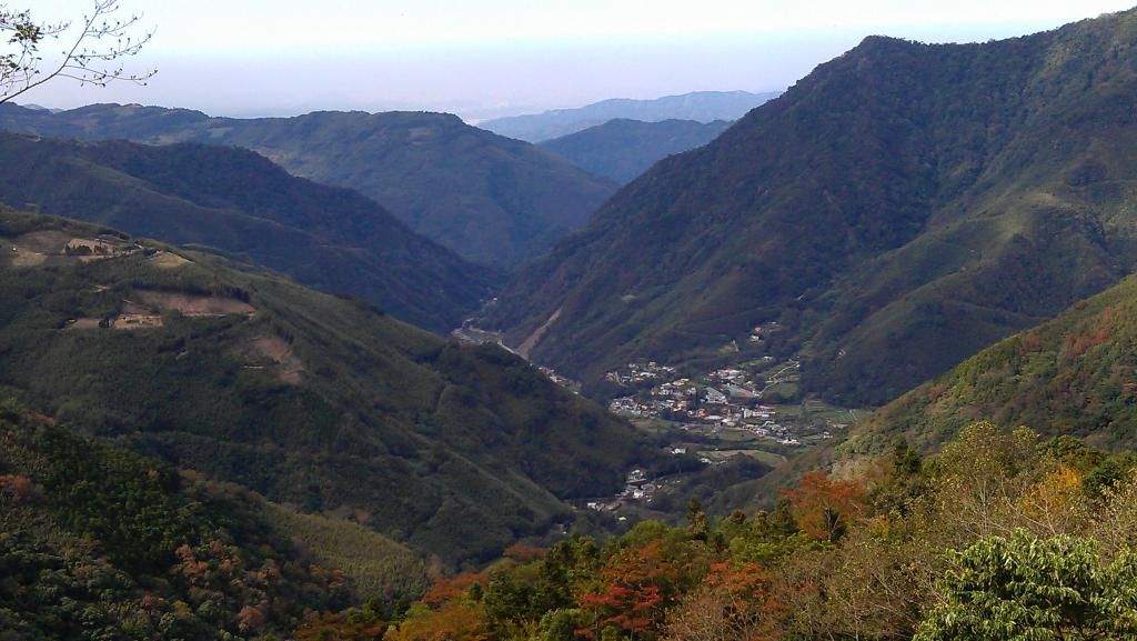
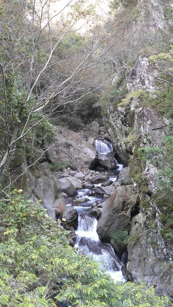
Anyway, the Miao 61 climbed gradually into the shadow of the mountains of Taian. You always know when you’re passing into aborigine territory because there are statues like this.

Right after that, I arrived at the Zhongxing checkpoint (中興檢查哨). The officer there informed me that parts of the Simaxian forest road (司馬限林道) were closed due to typhoon damage, and he drew me a map of the roads to Erbensong that totally came in handy later on. When I asked how the roads were, he said they were all paved, but there were some steep hills. He rode up there sometimes on his mountain bike, though, and he claimed to be able to climb them all without having to get off and push.
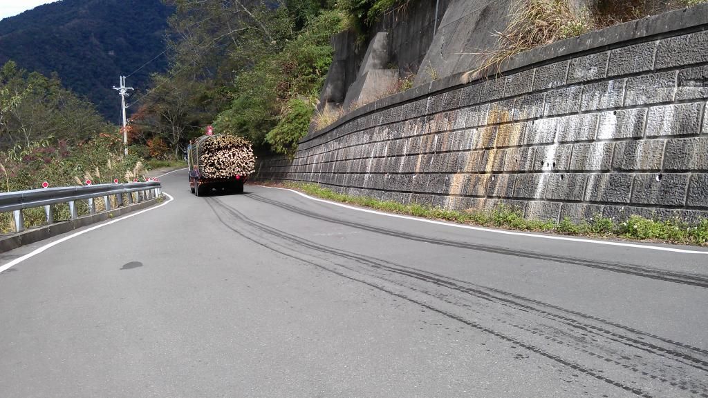
The next three kilometers were OK, but then I ran into the NASTIEST HILL EVER. It was so steep I didn’t know whether to laugh or cry. In my mind, I nicknamed it BCH: batshit crazy hill. I had already had to get off the bike for a couple earlier sections, so I didn’t even try to ride this one. “I’d like to see ANYONE ride up this hill on a bike,” I thought. “No way that guy at the checkpoint was telling the truth.” I should have taken a picture, but it’s a pain to take out my SLR from my front pannier and I wanted to keep a decent pace.
I found the first fork on the map the officer had drawn for me at 4.8K. I missed the fork after that, though, and soon my road turned into a rideable but increasingly rough strip of tarmac in the process of returning to a state of nature. The grade was nice (for a change) and the view was fantastic, so I kept going, hoping I would emerge from the jungle at some point, even though there wasn’t a soul around–all I could here were monkeys in the trees and the sound of a distant chainsaw. But after I plowed into a massive cobweb stretching all the way across the road, I figured it was time to turn back.
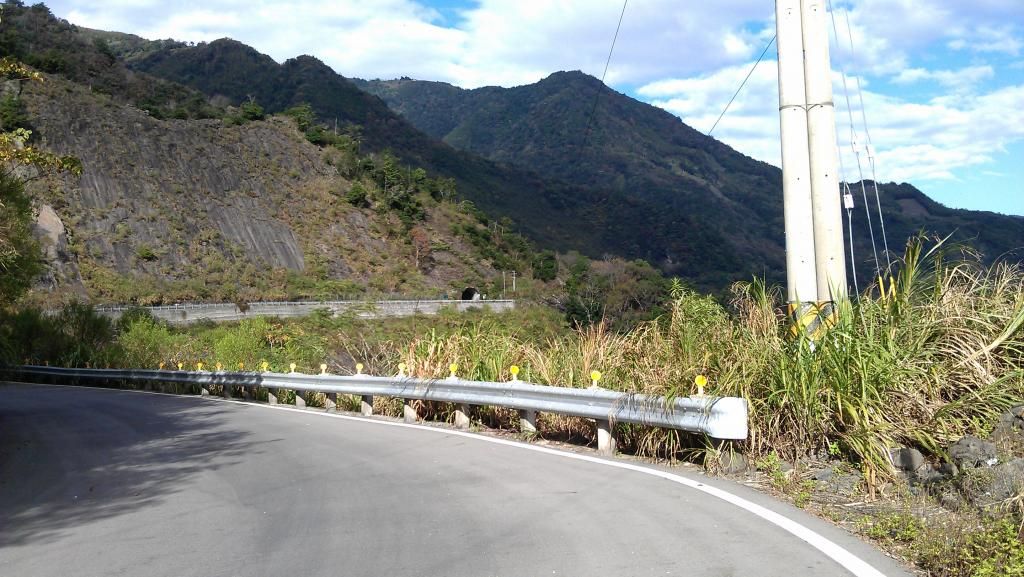
The road I was supposed to take was a strip of cement that for me was mostly too steep to ride. Maybe if I’d been on a road bike without racks and a full pannier, I’d have been able to get up it, but I’m not making excuses. Mercifully, it wasn’t too long. I finally made it back to the Miao 61 and continued on my merry way as best I could in a place that apparently doesn’t believe in posting road signs.
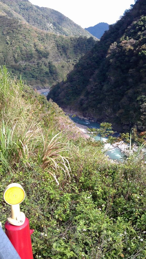
About ten kilometers from Erbensong (according to the car drivers I asked), there was a scenic overlook.


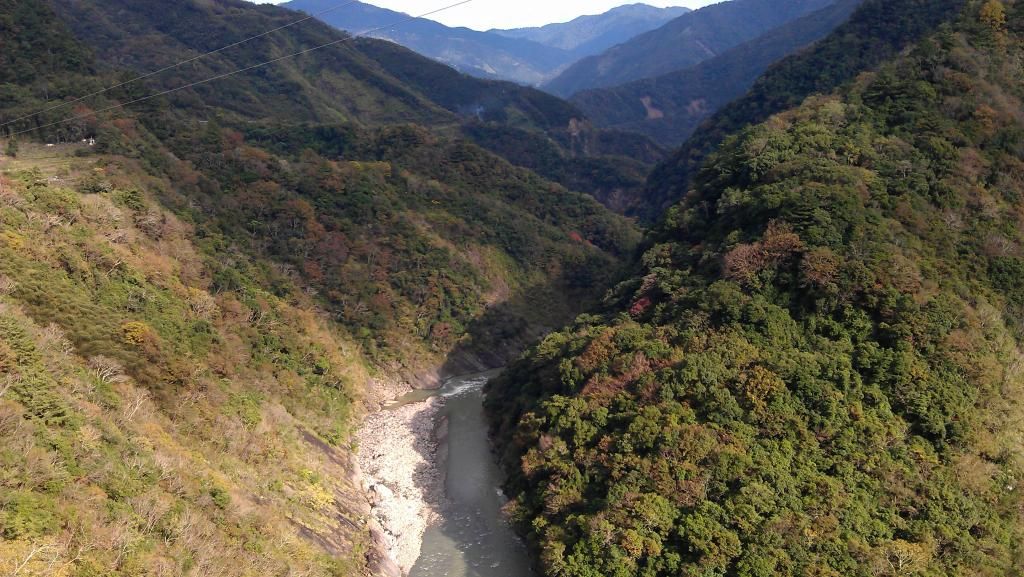
A few kilometers later, I passed through a little town and my road ended in a T. At this point it was after 2 pm, so I figured I’d better start heading out of the mountains. So I took the right fork and descended precipitously to the Daan River, the one flowing through the picture above. Below was another Atayal village, Tiangou/Tengu (天狗部落) with another memorable statue.

The rest of the ride took me over lots of small hills but nothing like the BCH–luckily for me, since I wasn’t up for much more climbing! Contrary to the forecast, the sun shone brightly for the rest of the day. It amazes me that in Taiwan one can ride over 100 kilometers in December and get up over 1000 meters above sea level without ever having to put on a jacket. As the sun sank over the river, it treated me to views like this.


I passed through a few more Atayal buluo before climbing over a hill from Heping into Dongshi. From there, it was just an easy descent on the 3 into Taichung.