Pingtung County’s Siaoliouciou Island (小琉球) is called Little Okinawa in translation. This little islet off the coast of Pingtung does not look like Okinawa [琉球] at all but for some reason for many years locals have nicknamed it as Little Okinawa or ‘‘Siao liou ciou’’ in Mandarin.
QUESTION: why on Earth ( and in Taiwan ) is it called LITTLE Okinawa and who coined the name for this islet? Is there a local legend or a story behind this mis-naming that somehow stuck?
Jesus TMD Christ, Taipei Times just won’t let go of Tongyong Pinyin, will they? Their ideological constraints are really holding that paper back.
Anyway… No, not Okinawa. Okinawa is 沖繩, whereas 琉球 is Ryukyu. (Okinawa is one of the Ryuku Islands, so confusing them is like conflating Taipei with Taiwan… which the country’s Olympic teams still can’t get straight!)
Liuqiu used to be a vague term for islands east of China (see Wikipedia), which would include Taiwan. We all know how non-specific Chinese can be at time, and this was no exception. So if Okinawa was Greater Liuqiu, Taiwan and its islets were Lesser Liuqiu. Which is funny, since the island of Taiwan is about 30 times the island of Okinawa…
Greater Ryukyu and Lesser Ryukyu began showing up in Japanese and Chinese documents around late 1200s. Greater Ryukyu refers to Okinawa, but it is never concrete where Lesser Ryukyu refers to.
Pre-European occupation, the first map showing Taiwan is a 1554 world map by Lopo Homem, which had an island named Fermosa, although has the shape and location of Penghu. In 1561, a Portuguese world map by Bartholomeu Velho had Taiwan divided into two islands. The one in the North is Fermosa, and the one in the south is Lequeo Pequeno, which would be Little Ryukyu.
Lopo Homem’s map. From the Penghu looking Fermosa northward, there’s Ilhas dos Reis Magos (Miyako jima), Ilhas dos Lequios?, Lequios?, Ilha do Fogo?, and I can’t make out the rest…
Ten years later, two Portuguese maps of East Asia, one dating 1568 and the other 1571, by Fernao Vaz Dourado and Lazaro Luiz had Taiwan divided into 3 islands. The one in the south is the biggest, the one in the north is the smallest, and there’s no label of Formosa anywhere. The island in the north is labelled Lequeo Pequeno.
A dutch map of China from 1584 by Abraham Ortelius & Ludovico Georio had Taiwan as 2 islands. Formosa in the north, and Lequeio Parva in the south. Later Dutch maps added a nameless middle island.
After the Dutch occupied Taiwan, they realized there is only one major island. The first European map with just 1 island would be the Dutch’s 1625 map of Packan (Taiwan), by Jacob Noordeloos. Then for a while they had Taiwan with only the west coast on the maps. Then they had the east coast, but believed it to be 3 smaller islands surrounded by the western regions.
After the Dutch and the Spaniards left the region, European’s knowledge of Formosa regressed and Taiwan was shown as 3 smaller islands again in a couple of maps back in the 17th century.
thank you both above, for good answers, that SETTLES it.
So that little islet is not Little Okinawa but Little Ryukyu [Fixed, edited, thanks below commenter]. Thanks for clariying that to this busasa map lover.
[quote=“Hokwongwei”]Jesus TMD Christ, Taipei Times just won’t let go of Tongyong Pinyin, will they? Their ideological constraints are really holding that paper back.
Anyway… No, not Okinawa. Okinawa is 沖繩, whereas 琉球 is Ryukyu. (Okinawa is one of the Ryuku Islands, so confusing them is like conflating Taipei with Taiwan… which the country’s Olympic teams still can’t get straight!)
Liuqiu used to be a vague term for islands east of China (see Wikipedia), which would include Taiwan. We all know how non-specific Chinese can be at time, and this was no exception. So if Okinawa was Greater Liuqiu, Taiwan and its islets were Lesser Liuqiu. Which is funny, since the island of Taiwan is about 30 times the island of Okinawa…[/quote]
At least they have some kind of system and not “I went to Harvard and I know how to write my name/everything else in English”.
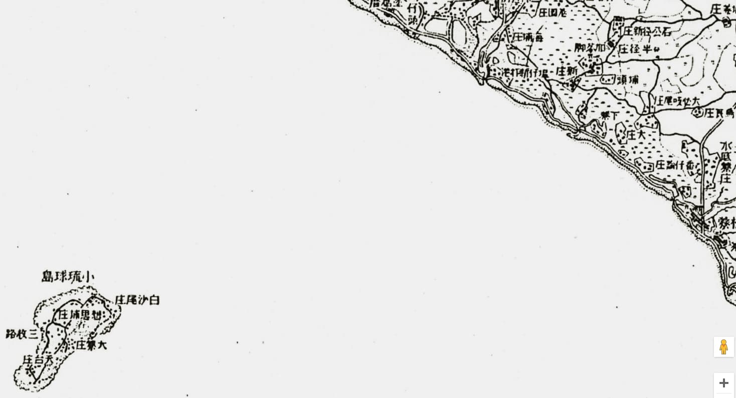
Shoryukyu Island Police Station Handbook is an introduction material for police officers assigned to Xiaoliuqiu during the Japanese era. According to it, “Shoryukyu island, may have been referred to as Samaki island before”
Within that same report, it mentioned a Qing dynasty geographic documentation of Fengshan, called 鳳山縣采訪冊, which referred to the island as
小琉球嶼(俗呼為剖腹山)
Xiaoliuqiu island (also known as phuà-pak-suann "lit. disembowelment mountain)
So it would appear even back in Qing dynasty, it was already referred to as Small Ryukyu.
Apparently, in the 1685 Taiwan Chorography (台灣府志) by Qing official Jiang Yuying, the name Xiaoliuqui already popped up, so the Chinese name may have started as early as Koxinga era.
An early Japanese survey of Akau (阿猴, present day Pingdong), the aboriginals referred to it as Kipoa (キポア, sounds really really similar to Quiapo district of Manila)
There’s almost nothing about 小琉球 in this forum (at least according to my search). Anyway, what’s this place like? Is it worth going to? The island is mentioned often among scuba divers, snorkelers, etc.
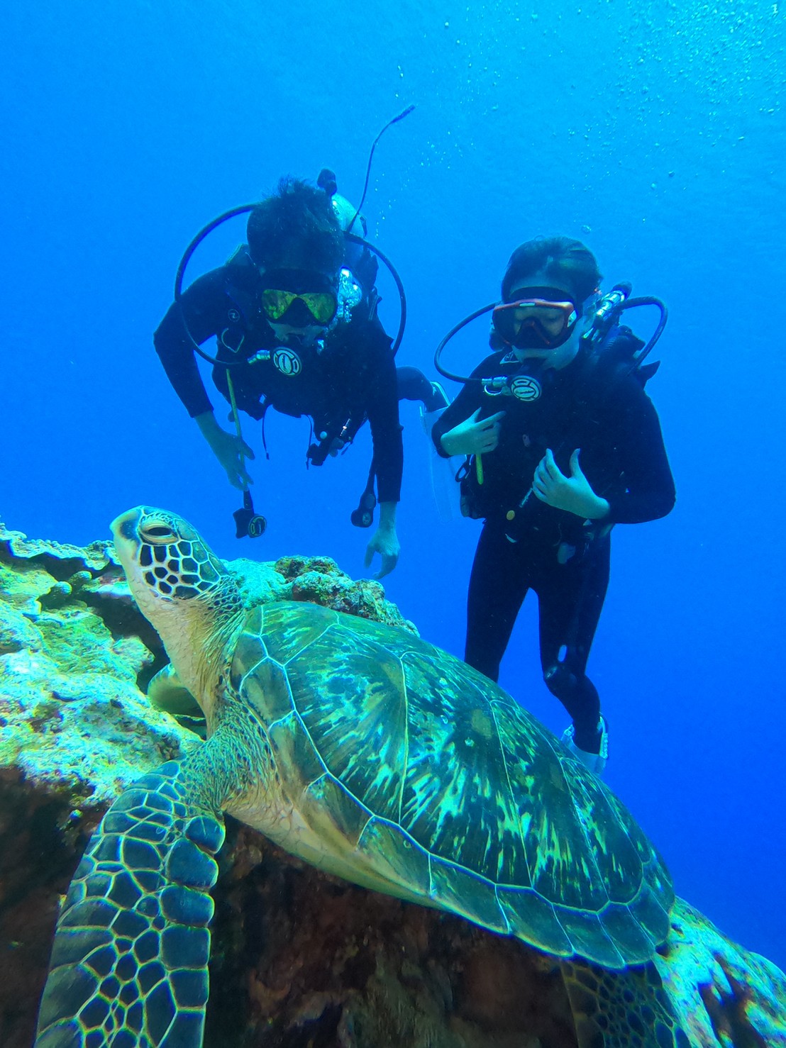
Tiny island, lots of tourists, cause of proximity to Kaohsiung. Best known for Vase Rock and snorkeling/diving with sea turtles. I like small islands. Taiwan should have more of them, like hundreds, not like a dozen or so you can visit. I’d go during off season, but of course, since it is in the south, it’s never really off-season.
Yes, great neat place.
Took kids there for snorkelling.
Just don’t touch/disturb the turtles.
It is an easy one-day trip if need be, or an over-nighter.
We actually scootered down from Kaohsiung city and took scooters on the ferry boat to the island.
It is awesome and one of the best and certainly easiest place in the world to see green turtles. You just swim out from the beach over the coral . Hard to believe but true. There are also cliffs where you look down and you can see them grazing. There are dozens of turtles living there year round.
It also has coconut crabs but they’ve become rare due to habitat destruction and too many motor vehicles.
The number of scooter riders is insane at times. The town itself is more renao than green island.
We luckily went the summer before last, so hardly anyone on the island as was pre-COVID.
The harbor is very picturesque. @marasan, I know you wouldn’t touch them. Some tourist did and got caught by the media.
A new place to post Ping-Tung travel info. It is a short hop east and south from where I am and place I do lots of day trips or in the case of Pingtung City a lunch or dinner and back home for me. I will later post some photos from some the small towns that a lot of people miss outside that are not in Southern Taiwan. i like Dongguan which has become a bigger draw, but there are some other gems that can be accessed but public transport but not all. (There are now quite a few car rental/hire places and Pingtung is breeze to drive around compared Kaoshuing or Taipei)
Maybe title should be "Pingtung (ex-Kenting) Tourism.
All kinds of nooks and crannies aside from Kenting.
Dapeng Bay a neat place to toot around on a bicycle.