I just got back from a trip to Dulan. My first time there, I really liked it. There was excellent weather over the weekend and then early Monday morning the wind blew in some very different weather.[/quote]
Come back again! We need the rain.
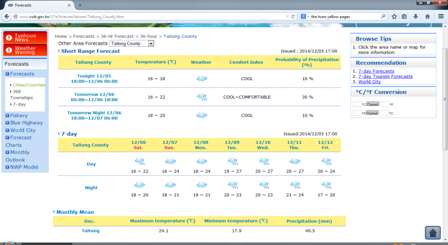
CWB is saying no rain for Taidong for the next few days, which is unusal because (a) they almost always have their default position of rain cloud icon and 30% POP, and (b) there will be a typhoon passing to the south of us which does seem to have a bit of a poleward outflow. Would have thought there was a reasonable chance of rain on Sunday-Monday at least when the outflow starts being directed over us.
Surf looks pretty good for those heading down this way.
Ok, i was wrong, CWB was right. Not a drop of rain last weekend in Taidong. In winter, it always seems like it’s about to rain at any minute here, but somehow rarely does.
This weekend is looking cold and dry. Huge waves during the week for the surfers and although they’ve dropped off a bit and look a bit ragged, should still be something to keep them interested this weekend if they can get out of bed early enough and beat the wind.
The nice thing is that no matter how cold it gets here, it’s colder and probably raining as well in Taipei.
Can’t quite track down the full historical statistics, but this year must be close to the driest on record for Taidong. It’s certainly the driest in the last 10 years - and that has included some pretty dry years.
The ave for Taidong is 1779.6mm. So far this year we’ve had 1177.4mm. The bulk of that came in a few major rain events.
On another matter, I don’t want to gripe about CWB, they’ve made a lot of great improvements in the last few years… but…
For Taidong they always seem to use the rain cloud icon. I understand their method is that if it’s 30% or above they use the rain cloud, but they only give that 30% pop figure for the next 36 hrs. For the other 6 days it’s just the icon and if you scroll over it, it invariably says, ‘Mostly cloudy with occasional showers’ - what they mean is ‘chance of showers’ but they always write ‘occasional showers’. Like it’s gonna rain several times during the day.
Ok, I know now not to pay attention to that, but if you were a tourist looking at their forecast, like the one below, then you would think that it was going to rain day and night for the next week! The reality is that it rarely rains here at this time of year especially - and there hasn’t been a drop of rain in the whole forecast period.
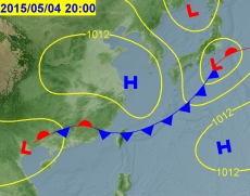
It’s that time of the year where the Mei Yu is about to crank up. Much needed this year coz Kaohsiung is on phase 3 water restictions. According to CWB’s forecast charts, it looks like it might arrive on Sunday in the north and Monday in the south. Probably north and west coast up to the central range will get the brunt of it.
[quote=“dulan drift”]It’s that time of the year where the Mei Yu is about to crank up. Much needed this year because Kaohsiung is on phase 3 water restictions. According to CWB’s forecast charts, it looks like it might arrive on Sunday in the north and Monday in the south. Probably north and west coast up to the central range will get the brunt of it.
[/quote]
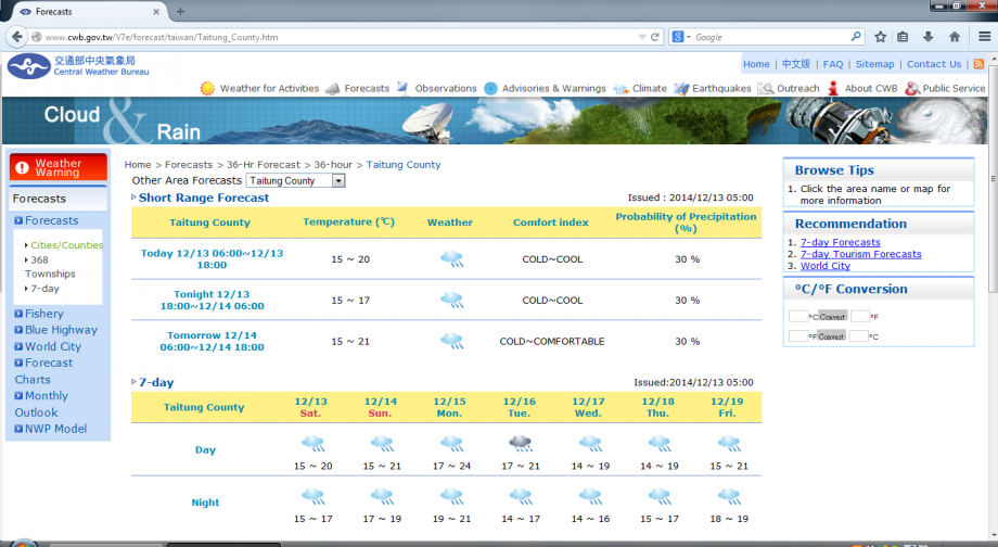
According to the CWB forecast it doesn’t look like any precipitation will fall south of Miaoli in the coming week. It sure looks like things will get worse before they get better with regards to the drought (and shitty air resulting from it).
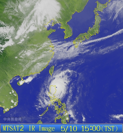
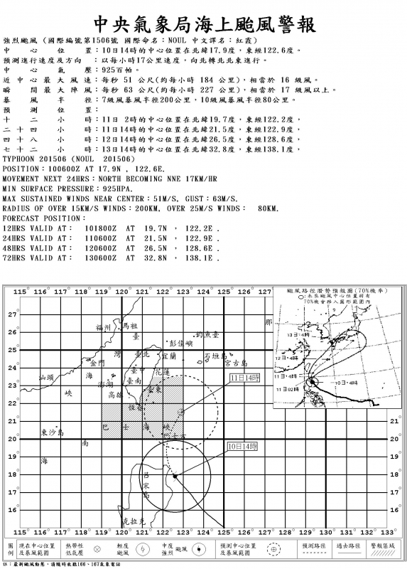
This is a bit like playing ‘chicken’ with a mack truck. Noul has become a super typhoon, and it’s currently heading straight at us, but all the forecast models have it about to recurve away to the ne. I’ve held off on doing much in the way of preparation because of that but i do hope they are right. Otherwise we’re gonna be in the thick of a super typhoon within 24 hrs.
If you are on Orchid Island, however, then you probably want to get off now. The planes and boats may not operate for several days after it hits.
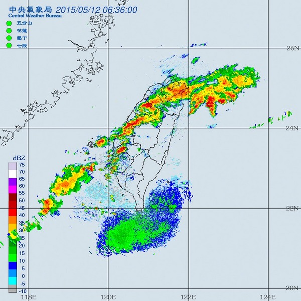
Not sure if this is straggling strand of typhoon tail or a mei yu front but it’s bringing heavier rains to the north and west coast than we got from the entire typhoon down here. 40+ mm in the last hour in some places - not bad going considering CWB has Taipei at 30% POP.
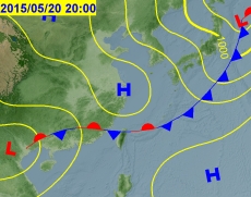
According to CWB, Mei Yu officially started on May 2, but it looks like the first ‘real’ front is going to form over Taiwan on Wed. Like any self-respecting ‘stationary front’ it should overstay its welcome and cause some havoc all week, especially in the north west. Southerners might have to wait a couple of days.
Also, a ‘strong’ El Nino event has been declared for 2015. Tried researching the effect of that on the mei yu and apparently the link is unclear. In theory it should weaken the mei yu but there have been several exceptions.
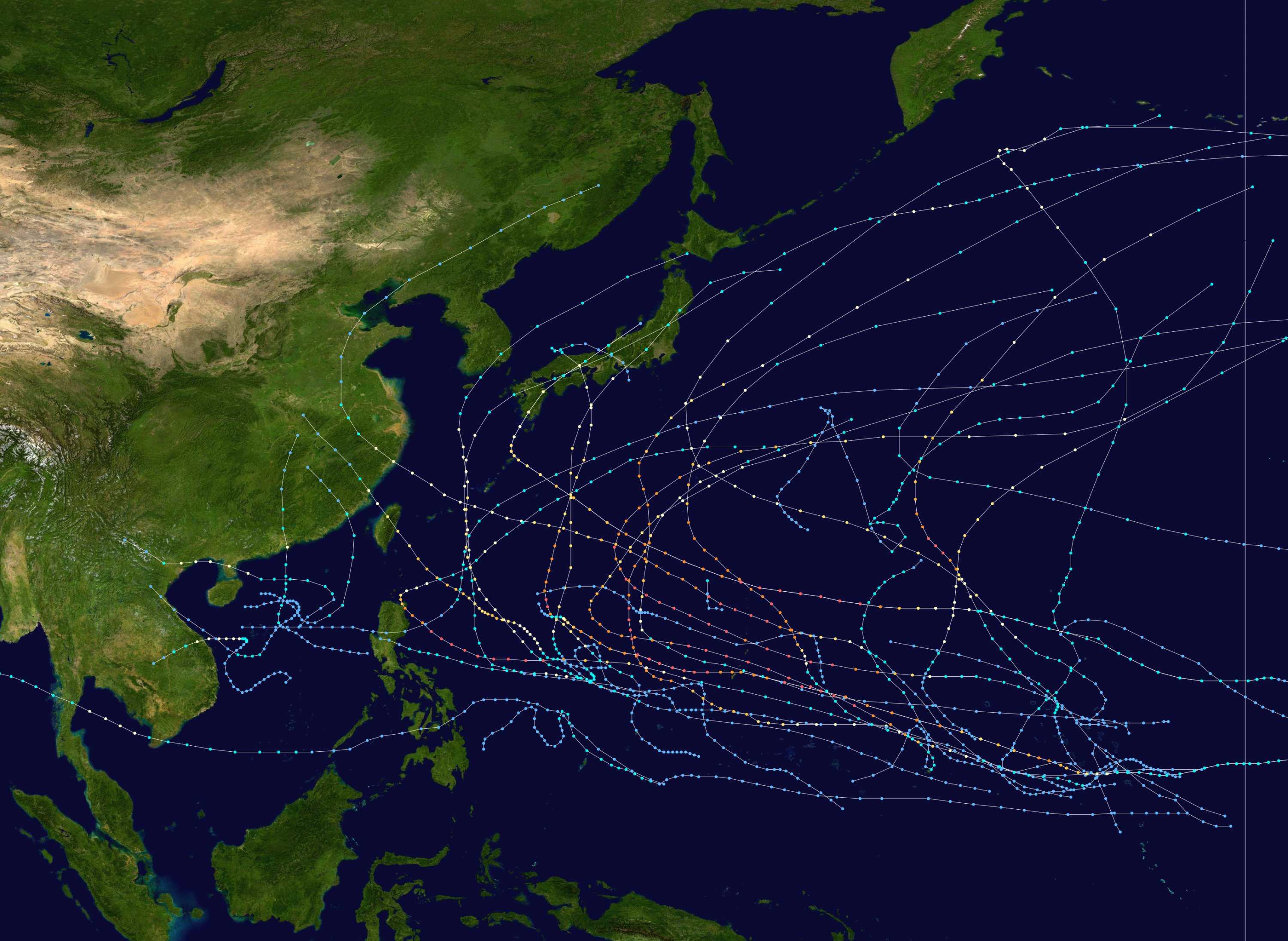
As for typhoons, the last strong El Nino was in 1997-98, and that saw a record number of typhoons form, though only one made landfall in Taiwan - most seemed to head north. We have already seen a record number of typhoons forming up to this time of the year in 2015 according to an article in the TT. taipeitimes.com/News/taiwan/ … 2003617541
They even expect the rains in southern Taiwan on Wednesday. It’s bittersweet. Getting rain is needed so badly but nobody wants on and off hard rain for a week+ like it is forecasted. Oh well. I guess it is a weekend to stay home and take care of shit (so much to do).
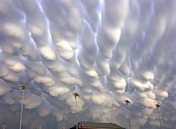
Was just thinking that there might be some mammatus clouds forming up north - they are about as close as you can get to weather porno. They are meant to, and do actually, look like lots of breasts in the sky. They’re rarely seen, but typically appear ahead of a deluge.
Here’s a photo - would be surprised if they were as pronounced as these beauties, but if they do appear, can someone take a picture and post it? Or is that wrong?
Was just thinking that there might be some mammatus clouds forming up there - my favourite kind. They are meant to, and do actually, look like lots of breasts in the sky. They typically form ahead of a deluge. Here’s a photo - I doubt they would be as pronounced as these ones, but if they are forming then I would love it if someone could take a picture and post it.