Here it comes!
Here it comes!
So tonight’s will be Bobby’s last walk in how many days? How long will the deluge last?
It looks like we will get some rain for at least a week but at some point it should become hard intermittent showers instead of all day showers. I am making no weekend plans though. Maybe I will walk around town this weekend ducking into various shops and using public transport.
Raining in 5, 4, 3, 2…
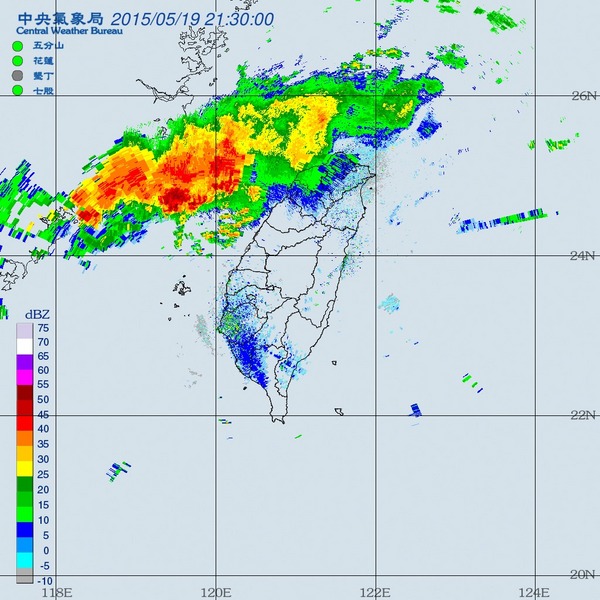
Starting raining Hualien.
Drip, drip, drip.
Nice and cool.
Fill up those reservoirs, rain!!
140 mm in Miaoli, including 60 mil in the last hour. That’s torrential.
140 mm in Miaoli, including 60 mil in the last hour. That’s torrential.[/quote]
but mostly only hitting coastal areas…

Looks like the south is waiting until this evening or tomorrow. But don’t worry we will all get wet this week.
That rainfall map shows a good 30mm+ in the Shihmen catchment already, with more on the way. 
[quote=“Nuit”]Spend the evening googling mammatus clouds images, icon. They’re lovely.
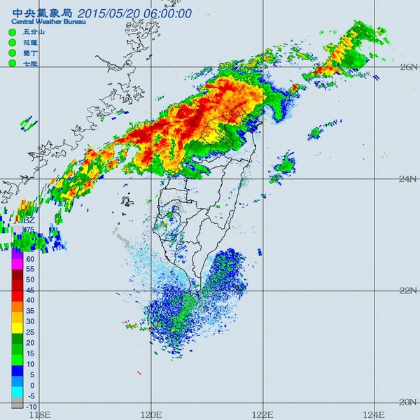
The extremely heavy orange rain warning is out for all of North & West Taiwan, as far down as Jiayi. Stay safe folks.[/quote]
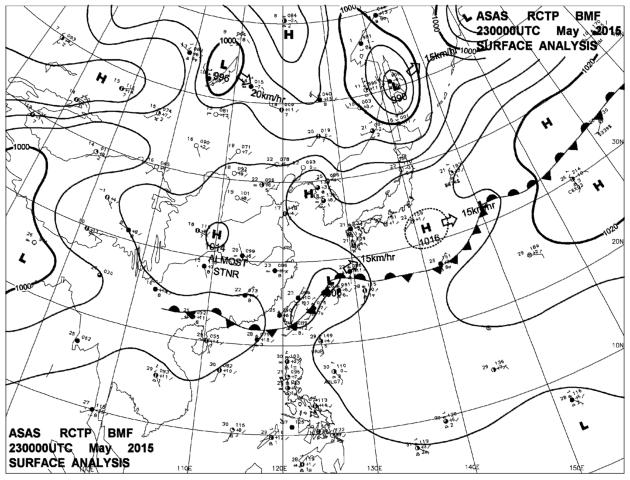
Weather warnings now:
Torrential rain for Jiayi, Yunlin,Taichung
Extremely heavy everywhere else except East Coast
Splish. Splosh.
This is probably the only time that I’ve been happy to drive my scooter to work in the pouring rain. Fill up those reservoirs! :bravo:
This is probably the only time that I’ve been happy to drive my scooter to work in the pouring rain. Fill up those reservoirs! :bravo:[/quote]
Just checking the rainfall map again, the catchment got 40mm+ to 50mm+ yesterday.
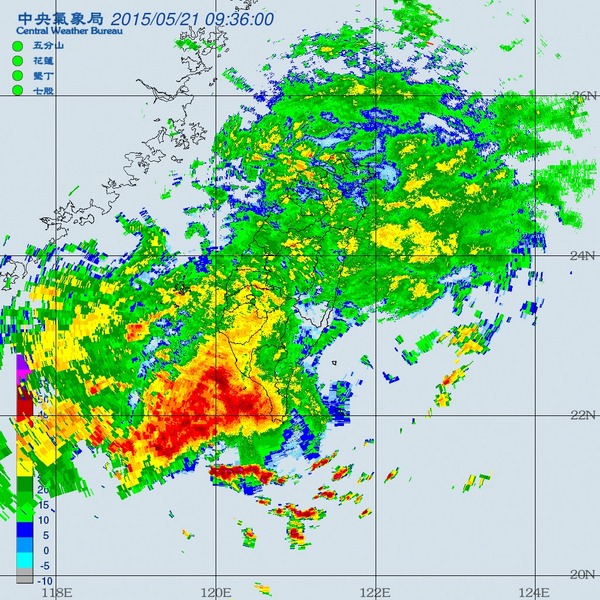
Looks like the whole show has moved down to the south today. A pretty intense storm cell sitting just off the south coast - Kaohsiung should get some big falls today.
Meanwhile in Taidong, no real rain, though i can hear an almost continuous muffled rumble of thunder on the other side of the range. Although the south east coast doesn’t get the full mei yu effect, we usually get one 100mm+ fall somewhere along the line - generally when the front gets down to the south and starts to tilt up the east coast - that could happen in the next day or so. The forecast hart below is for Saturday, though it may happen before then judging from the radar - it looks like it might be starting to creep up now.
The rain in Tainan is mild, not so scaring as predicted.
What’s more depressing is the low income of the thirsty reservoir from this rain!
[quote=“HomestayTaiwan”]The rain in Tainan is mild, not so scaring as predicted.
What’s more depressing is the low income of the thirsty reservoir from this rain![/quote]
Today was predicted to be a light day. They are expecting 100mm’s for each of the next 3 days so don’t start worrying about the reservoirs until Saturday.
The Mei Yu front seems to be stubbornly sticking to its southerly position - old timers talk about some huge mei yu events in the south and this may be one of those years. Taiwu in Pingdong has already had 400 mil in the last few days.
It’s also doing the ‘tilt’ thing today , whereby it sits just south of Taiwan and this allows it to arch up the east coast - that’s about the only way the south east can get serious mei yu action. It’s raining steadily now in Taidong but nothing dramatic as yet.
Anyway, with land, there are always things to do, so it’s nice to have an unequivocal day off. And as Susan Ertz said:
CWB has rain warnings for all of Taiwan. Heaviest in the south and central ranges. Though the north west seems to be copping it right at the moment.
Is there any risk of wide-spread train cancellations/heavy delays in this weather or is it not severe enough yet? This is my first ‘rainy season’ in Taiwan. 
Probably not from this storm but anything is possible.