A Whole New Perception of Taipei... by Bike

You guys must be talking about Ahrouyang Rd. which connects Shenkeng to Maokong. According to the warning sign at the top, the grade is 60%.

I’ve always ridden from Shenkeng to Maokong and when you descend down that section you just hold down the brakes for dear life with your butt hanging way behind the saddle. I can’t imagine anyone riding up in reverse direction without getting off the bike.

BTW, does anyone know about this offroad trail off Ahrouyang that also ends up in Shenkeng? I hear it’s near the Linda Rd hiking trail. The Maokong offroad is getting quite crowded with both hikers and mt bikers.

[quote=“Incubus”]You guys must be talking about Ahrouyang Rd. which connects Shenkeng to Maokong. According to the warning sign at the top, the grade is 60%.

I’ve always ridden from Shenkeng to Maokong and when you descend down that section you just hold down the brakes for dear life with your butt hanging way behind the saddle. I can’t imagine anyone riding up in reverse direction without getting off the bike.

BTW, does anyone know about this offroad trail off Ahrouyang that also ends up in Shenkeng? I hear it’s near the Linda Rd hiking trail. The Maokong offroad is getting quite crowded with both hikers and mt bikers.[/quote]

thanks for the photo…it should just say “abandon hope all who enter here”…i havent done any offroad yet (im new at this)…btw how is the linda rd hike? ive looked at that but never actually had a crack…

Where’s the Linda Rd hiking trail? Never heard of Linda Rd.

What kind of Muzha Man have I become? :frowning:

[quote=“Muzha Man”]Where’s the Linda Rd hiking trail? Never heard of Linda Rd.

What kind of Muzha Man have I become? :frowning:[/quote]

ah ha, caught you out there…its on the back road to shenken, half way down (so not mucha really)…theres a farm area with a springloaded door and a sign saying to linda rd trail…very mysterious. looks like it follows a stream bed…

Re: night cycling. A new generation of 3 watt LED bicycle lights is now available, including paired spot and flood lights. They can save your clavicle.

The worst aspect of the riverside bike paths for me is the motorists driving on them. Very taike.

[quote=“the bear”][quote=“Muzha Man”]Where’s the Linda Rd hiking trail? Never heard of Linda Rd.

What kind of Muzha Man have I become? :frowning:[/quote]

ah ha, caught you out there…its on the back road to shenken, half way down (so not Muzha really)…theres a farm area with a springloaded door and a sign saying to linda Rd trail…very mysterious. looks like it follows a stream bed…[/quote]
Linda Rd was named after Linda Arrigo, an American political activist and ex-wife of former DPP chairman Shih Mingte. Apparently, she was quite a hiking enthusiast and discovered this ancient path some years ago. The offroad trail I mentioned is not Linda Rd, which is not rideable, but it either crisscrosses it or runs parallel with it.

I know it’s not Taipei, but has anyone got any tips on cycling the East Coast? I’m planning on taking a week off in August and going down to Kenting (train/bus back). Is this possible … suggestions?

TIA :notworthy:

google search feiren and bike, and follow his bloggings. he knows the roads that side. south of suao is dangerous, and the tunnels between there and hualien can be tricky.

[quote=“teggs”]I know it’s not Taipei, but has anyone got any tips on cycling the East Coast? I’m planning on taking a week off in August and going down to Kending (train/bus back). Is this possible … suggestions?

TIA :notworthy:[/quote]

The recommended rides on the East Coast are Great Taiwan Bike Rides Part 1: Taidong to Hualien (Easy Version) and Great Taiwan Bike Rides Part II: Taidong to Hualien–the hairy-legged version. You’ll notice that these are both between Hualien and Taidong where there is less traffic.

I can’t really recommend the riding on the coast north of Hualien. Yilan(Toucheng) to Suao is dull flatland city riding for the most part, and as urodacus mentioned, Suao to Taroko is prohibitively dangerous. If you must ride down the coast, I recommend that you ride out to Fulong on the coast and then ride down to Luodong in Yilan and catch a bus going toward Hualien. Get off at Taroko. You can generally ride these buses by taking your front wheel off the bike and stashing it underneath. From Hualien follow the route in the first link to Taitung.

Taitung to Dawu is a boring wide road for 90km with trucks whipping by. A broad road shoulder makes it sort of tolerable. The ride from Shouka at the top of the South Link Highway down the Hengchun peninsula to Kenting is a classic 80km ride.

Frankly though riding all the way down the East Coast just can’t be recommended even though the Hualien to Taitung and Shouka to Kenting sections are very good. It’s doable, but there is far better riding in Taiwan’s mountains.

A much more interesting (but considerably more difficult) way to do this would be to ride out to Fulong, down to Yilan, and up the 7 to Lishan. From Lishan, take the over to the 14 and ride down and through Taroko–doing this at dawn before the tourist buses strike is an experience you’ll never forget. You will cross two passes over 2,000 meters. From Taroko, follow the instruction above, but consider taking a bus to Shouka from Taitung.

Let me know if you need more specific help. Google Maps is very useful these days.

Yes, kind of like they have named many roads after me.

Yes, kind of like they have named many roads after me.[/quote]

they named a whole animal after me :sunglasses:

[quote=“Feiren”]The recommended rides on the East Coast are Great Taiwan Bike Rides Part 1: Taidong to Hualian (Easy Version) and Great Taiwan Bike Rides Part II: Taidong to Hualian–the hairy-legged version. You’ll notice that these are both between Hualian and Taidong where there is less traffic.

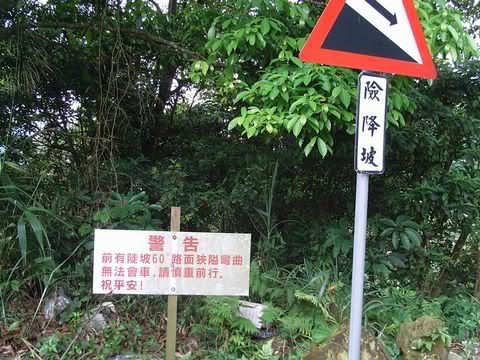
I can’t really recommend the riding on the coast north of Hualian. Yilan(Toucheng) to Suao is dull flatland city riding for the most part, and as urodacus mentioned, Suao to Taroko is prohibitively dangerous. If you must ride down the coast, I recommend that you ride out to Fulong on the coast and then ride down to Luodong in Yilan and catch a bus going toward Hualian. Get off at Taroko. You can generally ride these buses by taking your front wheel off the bike and stashing it underneath. From Hualian follow the route in the first link to Taidong.

Taidong to Dawu is a boring wide road for 90km with trucks whipping by. A broad road shoulder makes it sort of tolerable. The ride from Shouka at the top of the South Link Highway down the Hengchun peninsula to Kending is a classic 80km ride.

Frankly though riding all the way down the East Coast just can’t be recommended even though the Hualian to Taidong and Shouka to Kending sections are very good. It’s doable, but there is far better riding in Taiwan’s mountains.

A much more interesting (but considerably more difficult) way to do this would be to ride out to Fulong, down to Yilan, and up the 7 to Lishan. From Lishan, take the over to the 14 and ride down and through Taroko–doing this at dawn before the tourist buses strike is an experience you’ll never forget. You will cross two passes over 2,000 meters. From Taroko, follow the instruction above, but consider taking a bus to Shouka from Taidong.

Let me know if you need more specific help. Google Maps is very useful these days.[/quote]

Hey Feiren, thanks for the detailed post. I had actually been going from Google Maps when I planned my initial route, but I didn’t go into any detail. I was basically thinking of taking a bus from Taipei to Ilan and then cycling to the 9 and cycling that all the way down to Hualian. It looks like I’ll have to change from the 9 to the 11 at Hualian if I want to stay near the coast, and then back to the 9 around Taidong.

I’m obviously doing the trip for the scenery, but I do accept that quite a lot of it will be fairly dull riding. One of the main ideas is also spending some time in the little villages along the way and meeting some interesting people. This is why I haven’t done too much planning on the route as yet as I wanted to just play it by ear so that I didn’t have too tight a schedule to stick to. I’ve had some great times in the little places in this country and I find the people genuinely open and friendly (well most of them anyway).

I have 8 days at most to get to Kenting. If I’m slower than that I’ll catch a bus for the rest of the way, and if I’m faster I’ll have some more time on the beach there. Do you think the above is possible and how do you rate the safety of the route?

Oh, and I like your write-ups on your trips, especially the one from Hualian to Taidong. I’ve also read that the area around the sugar factory and Shanyuan (sp.?) beach are truly stunning.

It will take four or five days to ride from Yilan to Kenting. However, I strongly recommend that you do NOT ride the section between Yilan and Hualian. It is very dangerous with many tunnels and lots of truck traffic. Of course people do ride it all the time, but it’s just not a good idea. The ride out to Yilan can be quite nice if you use the back roads.

You are definitely right about the little villages and meeting people on the way. I recommend you try to spend an extra day in the Dulan area. The scenery will be great almost the whole way–the reason I don’t like Taitung to Dawu is that it is a big four lane road and I don’t like big roads.

[quote=“teggs”]
Hey Feiren, thanks for the detailed post. I had actually been going from Google Maps when I planned my initial route, but I didn’t go into any detail. I was basically thinking of taking a bus from Taipei to Yilan and then cycling to the 9 and cycling that all the way down to Hualian. It looks like I’ll have to change from the 9 to the 11 at Hualian if I want to stay near the coast, and then back to the 9 around Taidong.

I’m obviously doing the trip for the scenery, but I do accept that quite a lot of it will be fairly dull riding. One of the main ideas is also spending some time in the little villages along the way and meeting some interesting people. This is why I haven’t done too much planning on the route as yet as I wanted to just play it by ear so that I didn’t have too tight a schedule to stick to. I’ve had some great times in the little places in this country and I find the people genuinely open and friendly (well most of them anyway).

I have 8 days at most to get to Kending. If I’m slower than that I’ll catch a bus for the rest of the way, and if I’m faster I’ll have some more time on the beach there. Do you think the above is possible and how do you rate the safety of the route?

Oh, and I like your write-ups on your trips, especially the one from Hualian to Taidong. I’ve also read that the area around the sugar factory and Shanyuan (sp.?) beach are truly stunning.[/quote]

i recommend you ride from Taipei to Sanxia, to Fuxing, past Lalashan, and then stay at MingChe overnight, then next day ride down to the Yilan valley, and ride south to Lishan, and stay there night two, then head down Taroko gorge the third day and finish south of Hualien that night.

or ride from Taipei to Pinglin, then across to Yilan, then inland south from Yilan to Lishan, then as above.

[quote=“urodacus”]i recommend you ride from Taipei to Sanxia, to Fuxing, past Lalashan, and then stay at MingChe overnight, then next day ride down to the Yilan valley, and ride south to Lishan, and stay there night two, then head down Taroko gorge the third day and finish south of Hualian that night.

or ride from Taipei to Pinglin, then across to Yilan, then inland south from Yilan to Lishan, then as above.[/quote]

Thanks again for the info guys! I think my next step should be familiarizing myself with the route a bit better because, although I recognize the place names mentioned above, I have no idea where they are.

Teggs, I have written up the first leg of the route urodacis is referring to in Great Taiwan Bike Rides VI: The Northern Cross Taipei-Sanxia-Baling-Yilan. Another more challenging version is Great Taiwan Bike Rides XI: Northen Cross Remix

After that, just go up Highway 7A to Lishan and then on 8 all the way down to Taroko. This is fact the way I plan to do my dream version of the Around the Island ride via the various cross highways. After Taroko, I will ride down to the southern cross, go up through Sanmin, Chashan, Alishan, Yushan and down into Nantou. Just need to find some good mountain roads around Taichung and then Miaoli-Taipei by the back roads.

[quote=“the bear”]oh and dont forget the scenic cemetery hill climb from liuzhangli MRT/chongde Rd…its a lot of fun at night up there if you aren’t creeped out by all the dead people…[/quote] Yeah, try riding up that road sometime during ghost month at night. You’ll feel that it’s a bit heavier to pedal than during the day. Whatever you do, just keep pedaling and DON’T LOOK BACK. :noway:

put some trippy music on your ipod for the full freak-out effect…

I thought there was a night ride thread but I can’t find it, so I’ll post here.

A good uphill night ride.

For those of you coming from the city ride along the riverside paths to the endof the Jingmei path. Follow the road .5km to the start of the path to Muzha. Follow that about 3km. Pass under a bridge and then when you approach another (labelled Yi Shou Bridge) head up the ramp. Turn right and cross over the river and follow the ramp down. Now if you turned left and then left again and followed the road all the way up and then down you would be on the No 9 to Pinglin.

But for a good night ride, turn right and right again. Then just follow this road up for 4km or so until it levels out and then does a 180 and heads back down. Great views over the city and of 101. And light on traffic. I saw one car going up and 3 going down. Other than that is is just crickets and cicadas and tree lined roads.

Follow the road down all the way to the end and at the final T-junction turn right. Jenda University back gate is right in front of you. You can ride throughthe uni for more uphill and more great views. The uni is also traffic controlled.

Or you could just rejoin the riverside paths.

If you did this route during the day and wanted to do a little offroading, when the first uphill road makes a complete 180 take the first side road heading back and up to the right. Just before the top of the pass you’ll see a dirt road to the left. Follow it up and follow the trails along the ridge. Eventually you’ll end up at Maokong Gondola Station.