I think it’s safe to say, don’t feed them at all.
to help stop the stray dog problem from growing or what?
The bentos are oily and salty, not very good for their health…or ours, but definitely worse for them.
I really wanted to do that decent all at once because it’s pretty awesome, but stopping at the No. 7 77km sign to take pics is like…a right of passage. I guess it’s unlucky if I don’t?
Still waiting for the next time I get to attempt this monster of a route.
@ranlee This post is incredibly helpful, thank you! I’m planning to hop over from Hong Kong to visit Taipei with my bike at the beginning of October, and will definitely be doing a few of these rides. Just need to get used to riding on the other side of the road…
Hope to see you out on the road - would be great to find some company or group rides to join.
1 Like
@voodoo_economics No problem! This is why I created the thread.
Feel free to PM me on your schedule and I am sure we can make something happen.
1 Like
Definitely, will be in touch once I’ve got my dates finalised. Thanks!
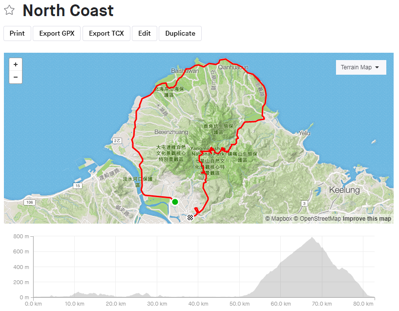
Route name: The North Coast 北濱
Start point: McDonald’s in Beitou Google Maps
End point: McDonald’s in Shilin Google Maps
Traffic level: Moderate/High
Main climb(s):
Total estimated distance: 80-100KM
Total estimated elevation gain: 1,150M
Max elevation: 788M @ Xiao You Keng Parking Lot (Google Maps)
Difficulty: Beginner/Moderate/ Hard /Wish you never got up this morning
Description:
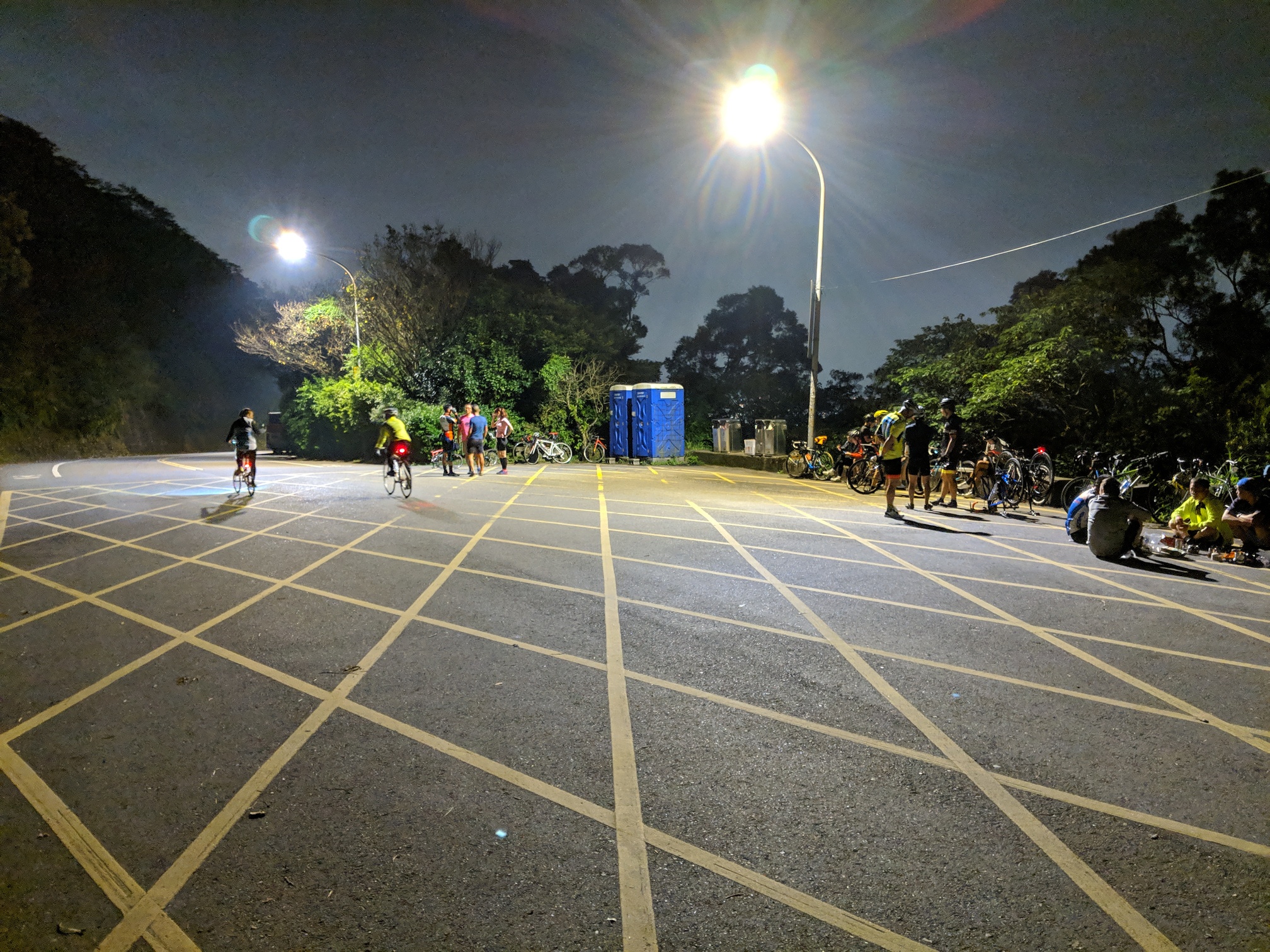
This is another classic Taipei route that was one in which I was very scared of when I first started cycling, but has become a staple route for me for training. Everyone’s start points will be different, but to make it interesting, I made the start and end point at a Mcdonald’s.
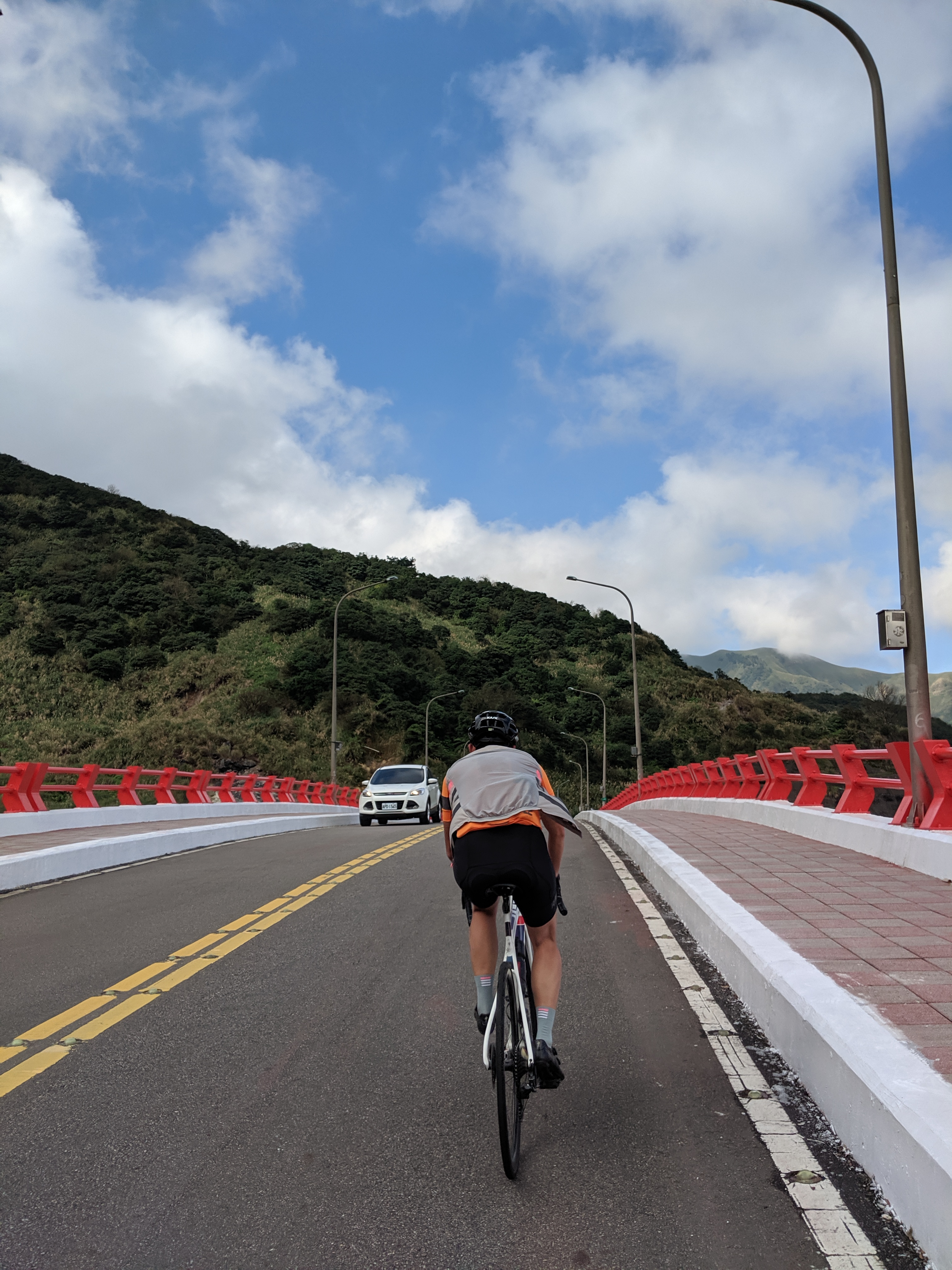
Make sure you start this one early as riding through the Bing Hai area by Hong Shu Lin MRT station can get busy mid morning and there’s no shoulder! Lots of local riders like to take this one at full pace starting from Guan Du, but with all the traffic lights you hit, it’s really tough to really get a pace going. Best part to start your training is when you get over the hill before Ba Sha Wan. You have a nice long 20k stretch with awesome views and a wide shoulder to ride through.
This is a very popular cycling route, so you are bound to run into other cyclists along the way. Do not forget to be polite and ask if you can join in on pace lines!
Unless you’ve come prepared, make sure you make a pit stop in Jinshan at either the 7-11 at the corner of the street or if you are on a more leisure ride, my favorite spot to stop is this My Warm Day Google Maps an alley or two behind the 7-11.
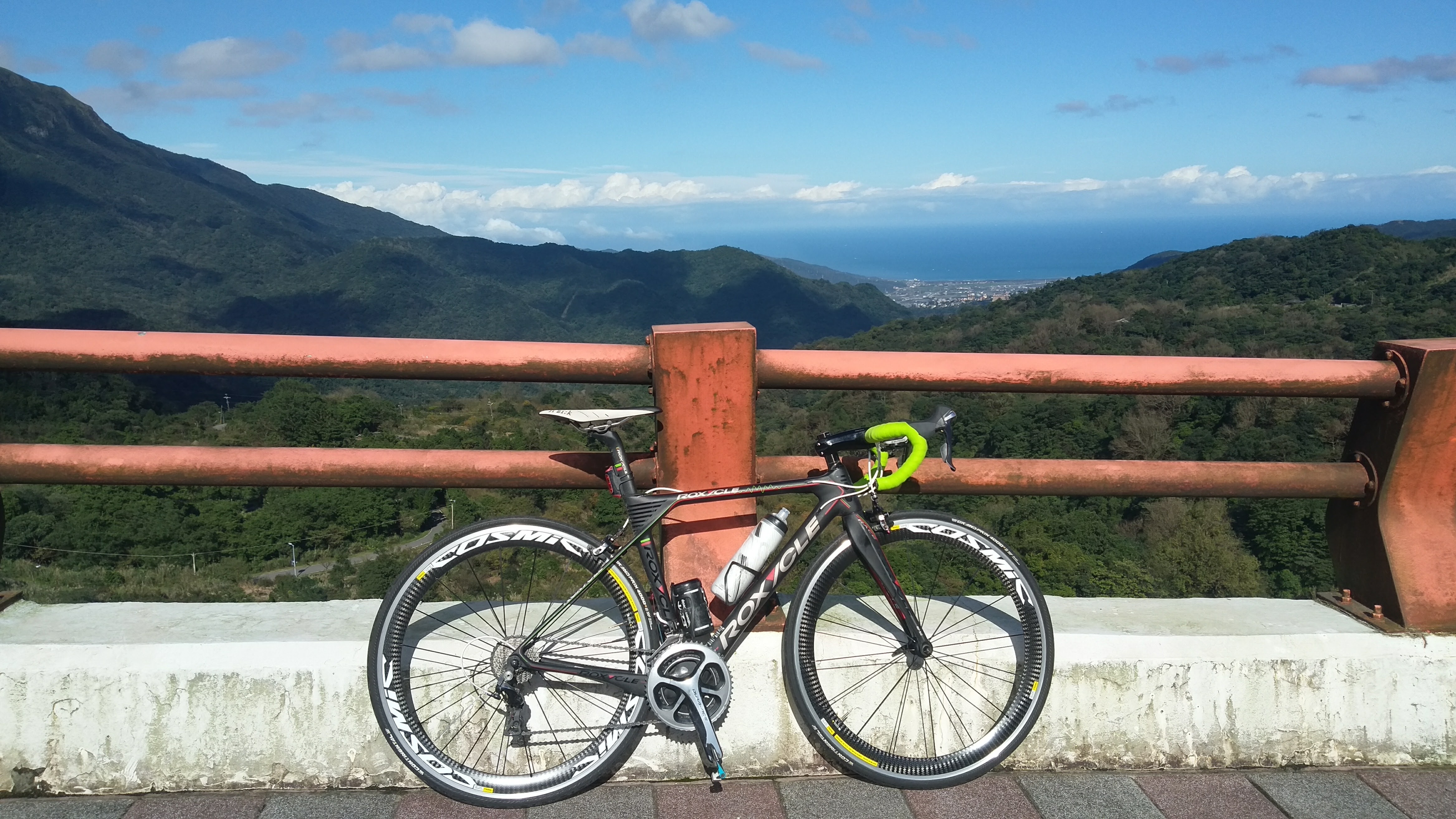
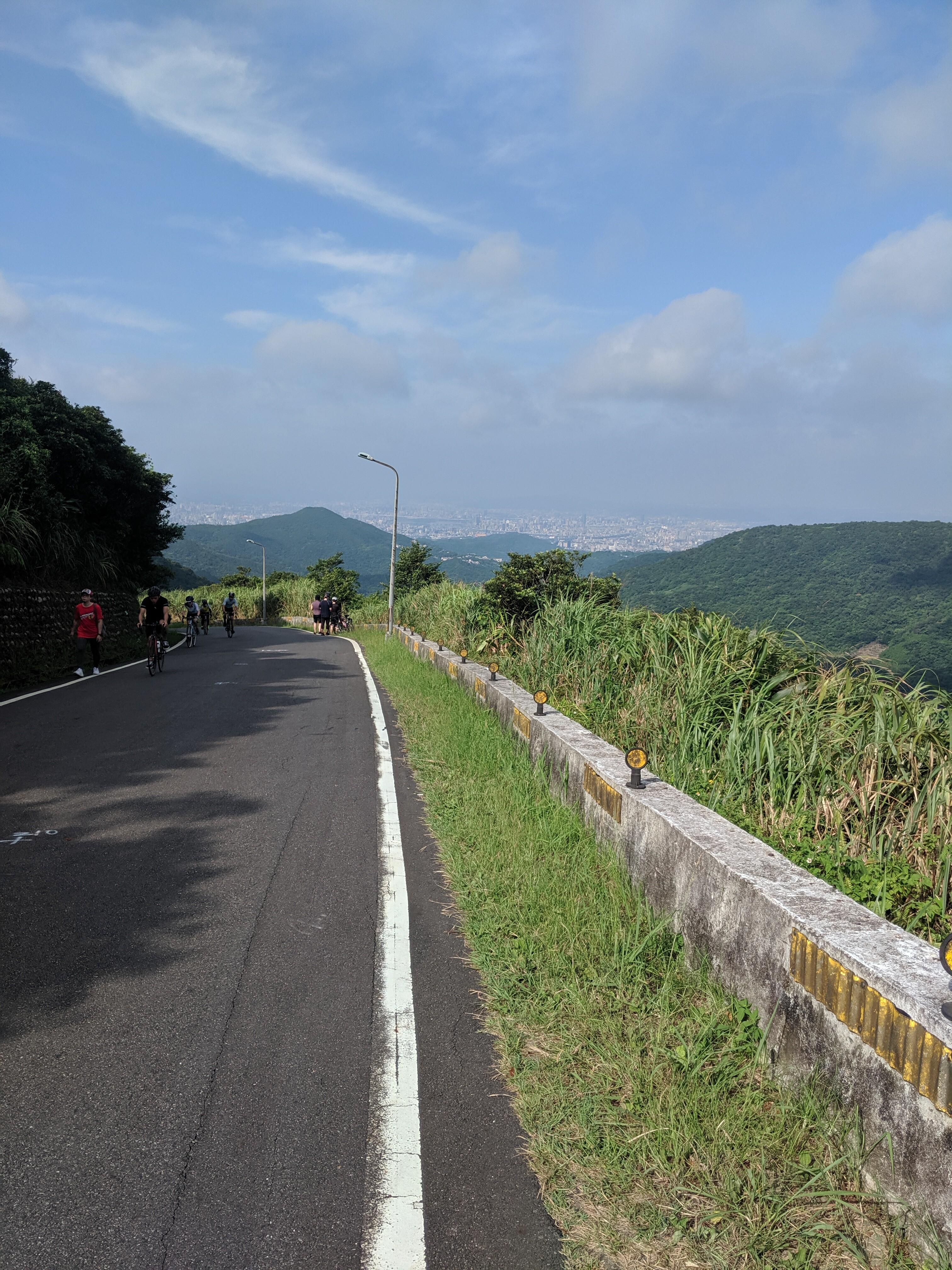
Next up, you got a nice long 17km segment taking you from sea level to almost 800m above sea level. After you a hit a bump after a long flat stretch and go into a long steady climb, make sure you save some gas! This section (https://www.strava.com/segments/12087911?filter=following) This section is the highest average gradient in the entire climb. Once you hit the Yang Ming Shan National Park sign is when gradient lowers and you hit a lot of switch backs.
Whenever I go over this bridge, I know there’s about 3km left and I start to use up the reserves. This is also a nice picture spot if you are taking it easy and just want to snap a nice pic.
ALTERNATE OPTION
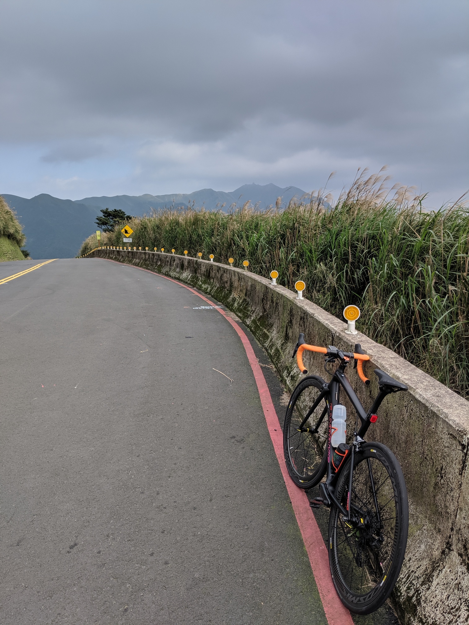
There’s a turn off about 1.5km from the top that goes to Zhong Hu (中湖) , the kick is…it’s a kicker! Here’s the segment 新陽金P字道 / 中湖戰備道(陽金端)~高點 | Strava Ride Segment in Beitou, TW . You have about 0.25km with average gradient of 10% to finish off the route. It’s an ultimate finale to the ultimate climb.
It’s worth it though, the view is pretty awesome with the little dip at the end of the road.
Your final feat is to rush down the mountain, but if you started early, you wouldn’t have the issue of descending with too many cars! Be careful on the descent and make sure you are well rested as it’s roughly a 14-16km descent from the top! Accidents have happened during weekend traffic so do be careful!
4 Likes
Route name: Fulong - Coastal - Bei Yi
Start point: ShiDing 7-11 (Google Maps)
End point: Xindian MRT (Google Maps)
Traffic level: Moderate/High
Main climb(s): Toucheng, Yilan > Shiding, New Taipei (Helen) | Strava Ride Segment in Toucheng Township, TW
Total estimated distance: 140km
Total estimated elevation gain: 1800m
Max elevation: 540m
Difficulty: Beginner/Moderate/Hard/Wish you never got up this morning
Description:

I recently did this ride at almost full gas and nearly died. So, I figured I would share! ![]() Below are rest spots in chronological order:
Below are rest spots in chronological order:
- 7-11 PingXi: Google Maps
- FamilyMart ShiFen: Google Maps
- 7-11 FuLong: Google Maps
- Hi Life: Google Maps
- Q Frog Bubble Tea JiaoXi: Google Maps
- FamilyMart PingXi: Google Maps
- Helen’s Coffee: Google Maps
- Xindian MRT 7-11: Google Maps
Key to this route is to start early and try to avoid the weekend! It can get really really hot after Ping Shuang Tunnel in summer months (which is very early on in the route) as there’s not much shade! Traffic tends to be a bit high from Fulong all the way back to Xindian on weekends with the crowd trying to avoid the highway.
Meet up point for this ride in in Shiding 7-11. Make sure if you did not bring any snacks and/or had breakfast, that you buy/eat it here! The rest stops are above, but if you do not plan to stop until Yilan, this is the place to supply!
Most cyclists are familiar with the ShiDing to Pingxi section where you have constant rolling hills and then a short (low gradient climb) to the Ping Shuang tunnel into a nice 3-4km downhill.

After you set off from Fulong to Yilan, the road conditions are good and you are riding through very similar terrain as ShiDing to Fulong, rolling hills! Do be careful of the trucks along the route as many take this road from Yilan to get to Keelung port!
Your last challenge for the day is climbing Bei Yi back to Xindian. For those that prefer to end their ride here, no worries! You can hop on a local train back to Taipei or take a charter bus back from here Google Maps. No bike bags necessary for both modes of transportation!
For those who decided to continue the hurt, this is a view half way up the first climb that waits for you:

For the final climbing portion before PingXi, just make sure if you made a stop beforehand to buy fuel! You need to be eating and drinking for this part as you are most likely fatigued and will need something to keep you going! It’s a very long 30km with one bathroom at the top of the initial hair pin climb (after 10KM), but no stores until PingXi!
Before descending into Xindian to finish the route, remember to be well rested with good spirits. Take a quick coffee break at Helen’s Coffee and enjoy the view. What follows may only be a descent, but it is a 14km descent after having well over 100km and 1800m of elevation behind you! You need to have a clear mind in the final 2km of the descent when you get into the busy Xindian MRT area!
Good luck!
7 Likes
Good to see this thread revived. Sigh, most of these routes are just too challenging and time-consuming for me. Has anyone done the Xizhi Pigeon? Looks like a fun little ride. Now if only I could figure out where all the key turns are.
2 Likes
@marasan should know this route quite well.
There’s actually not too many turns on the route. You just have to make sure you cross the right bridge to get from one side of the river path to the other.
1 Like
I haven’t done it. I see it all the time as I’m connected with people in the area on Strava. My advice is to join the Xiwan Bike Club to see when they ride together and then just tag along. They can be found on Facebook:
汐萬百科
And does this link work for you?
2 Likes
Ah, perfect! Your route even added the beak of the bird. Will give it a try sometime.
1 Like
4 posts were merged into an existing topic: Putting Bikes on Trains in Taiwan: How To Get Around By Rail
Any beginner routes??? I keep reading “wish you never got up this morning” on a lot of them lol
1 Like
There’s been a slight increase in requests for simpler routes as of late.
The original plan for this thread was to list routes that are not often ridden as they do require some navigation and planning.
Do you guys prefer I start listening Strava segments around Taipei in a separate thread?
Route name: Wind Middle Sword 風中劍 (真風中劍(劍南路-中社路-風櫃嘴) | Strava Ride Segment in Zhongshan District, TW)
Start/End point: Jian Nan Road MRT (https://www.google.com.tw/maps/place/劍南路站/@25.0847772,121.5539321,15.77z/data=!4m5!3m4!1s0x3442ac13b80dbd11:0x7ac5d6f77d03fa8c!8m2!3d25.0848628!4d121.5555963?shorturl=1)
Traffic level: Moderate
Main climb(s):
- Jian Nan Road: 劍南路 (由北安路上) | Strava Ride Segment in Zhongshan District, TW
- Zhong She: 中社路 full climb | Strava Ride Segment in Shilin District, TW
- Feng Gui Zui: TAS: WanLi Bridge-FongGueiZuei (5.4k) | Strava Ride Segment in Shilin District, TW
Total estimated distance: 22km
Total estimated elevation gain: 1,158m
Max elevation: 500m
Difficulty: Beginner/Moderate/ Hard/Wish you never got up this morning
Description:
This route is a combination of the three most popular climbs in Taipei. The first word of their climb names makes up this route name! I set the difficulty to this route from beginner to hard, as you can do as much as you can.
There’s also no right way to ride these climbs. You can choose to do Feng Gui Zui, Jian Nan and then do Zhong She because you can!
There’s one convenient store on the above route before the final climb (https://www.google.com.tw/maps/place/連益商店/@25.1196101,121.582135,18.58z/data=!4m5!3m4!1s0x3442ad9659850723:0x35a9ba41830883f!8m2!3d25.1193099!4d121.5831392?shorturl=1), but if you want to take a quick break, the National Palace Museum 7-11 is just right down the road from each of these climbs (https://www.google.com.tw/maps/place/7-ELEVEN+至善天下門市/@25.1004822,121.5504764,17.46z/data=!4m5!3m4!1s0x3442ac3b0607e563:0x4d694e62d0b5996c!8m2!3d25.1004757!4d121.5509487?shorturl=1).
The first climb, Jian Nan Road, is a road many are familiar with. Many take it to avoid riding through the tunnel, others like to add bit extra to their ride. With roughly two major hair pins to it, this climb is easily accessible and finish before you know it!
The second climb, Zhong She, is a little bit higher in traffic than the others as the entire road is a community, with buses that go up and down all day. Please be careful when attempting this climb! With a police station within the first KM of the climb, you can stop here to fill up on water if you are running a bit low. This climb is quite simple if you take it slow, but relentless if you want to gun for a personal best as it is constant uphill with little to no segments to rest!
Finally, the most popular climb in all of Taipei, Feng Gui Zui. On the weekend with nice weather, this road is packed with cyclists as well as paparazzi snapping your pics! Make sure you put on your nicest kit and smile for the camera! In terms of this climb, you have everything from hair pins, flat sections, rolling hills, steep sections and a headwind finish. It is by far the most difficult climb in all of Taipei to get a good rhythm going.

For more info on the climbs, please refer to the Strava segments for distance and average gradient!
3 Likes
I love seeing these routes, but as a beginner I wouldn’t mind seeing popular, easier routes here as well. As long as they’re labelled as “beginner” I’d get the gist.
Thanks again for putting these together, can’t wait to try them.
To start, if you want level up in climbing, you can stay on Jiannan road (slowly) and then Zhishan road (until Shengren falls) then turn back toward the river and Guandu to do some kms.
1 Like