[b]LOCATION:
Yilan, near Yilan Sports Park.
24° 45’ 00" N 121° 46’ 00" E
[/b]
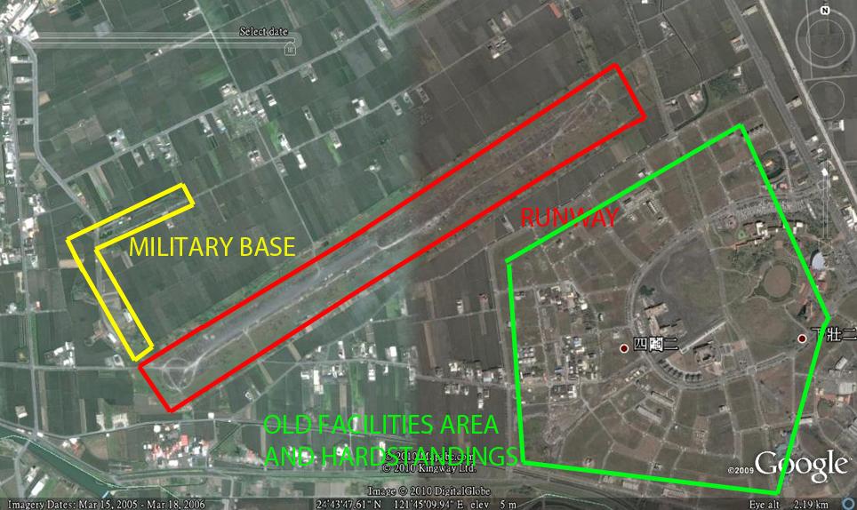
GE SATELLITE VIEW OF AREA:
BACKGROUND
Unbeknown to most people is the existance of an airfield situated in Yilan which was built before WW2; before the Japanese declared war on the United States.
I thought it would be interesting to share some of the information I have gained about this area here on Forumosa.
There were originally 3 airfields constructed in Yilan: the south airfield, the north airfield and a “secret” airfield. Although I have asked many people in the area, I only know the location of one airfield, which is the south. Attempts to find traces from aerial photographs, maps and Google earth of the other airfields have proved fruitless. However, they were located very close to one another.
Parts of the south airfield are still there, although most of it has been bulldozed and is in the process of being built on (why save it for historical purposes??).
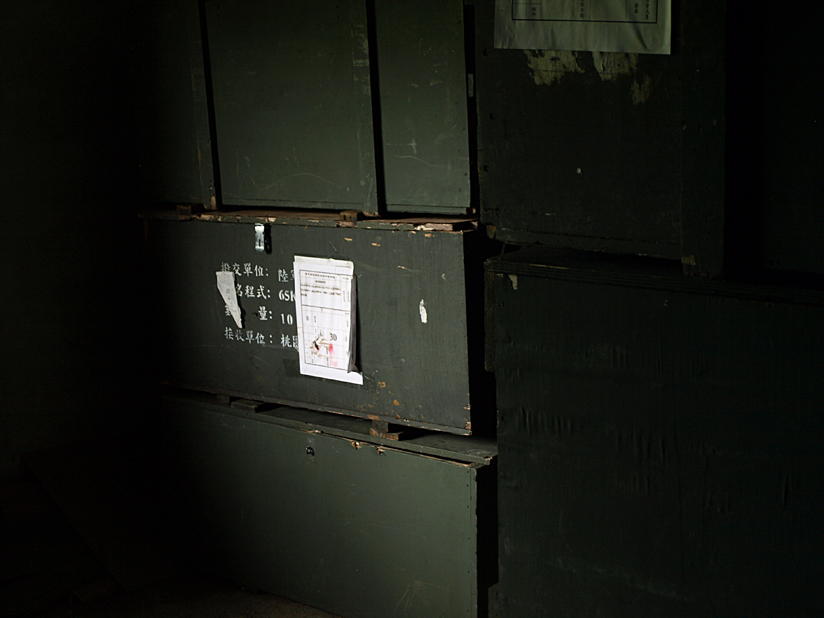
There is part of the airfield which is off limits to the public due to the fact that it is still a live base, as I unwittingly discovered. The military decided to construct a gate and a guard house on the access road to the base, but the perimeter of the base is open to rice fields so any spy dressed as a farmer can see what’s going on inside. I even managed to get into a storeroom and take pictures of boxes of flares before I realised I shouldn’t really be there.
HISTORY
Airfield construction was commenced in 1936 and finished during the same year. Construction was achieved mostly by asking (demanding) the students of the local agricultural college to provide labour. The construction of the airfield was mostly done by hand and very few machines were used.
In 1939, the airfield took on another role as a weather observation station, and a meteorological observation building was constructed which is still in existence today, but has been relegated to agricultural use.
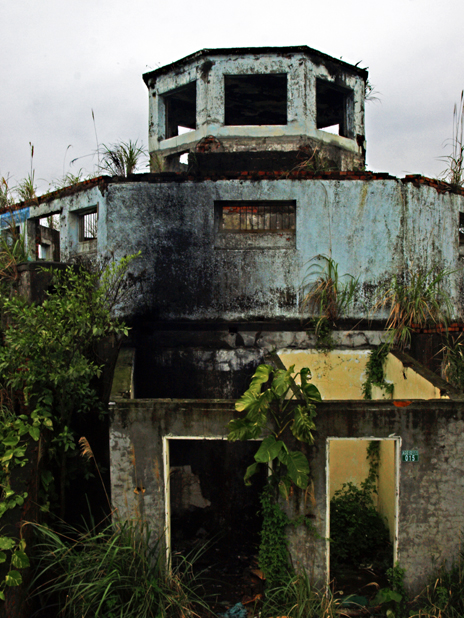
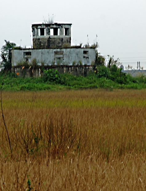
Also in 1939, the control tower was constructed. This also remains.
While the north airfield was reserved almost exclusively for aircraft parking, the south airfield was used extensively during the war as a launch point for Kamikaze pilots attacking allied fleets and it proved to be a sound target for allied aircraft. The airfield was bombed extensively during the war.
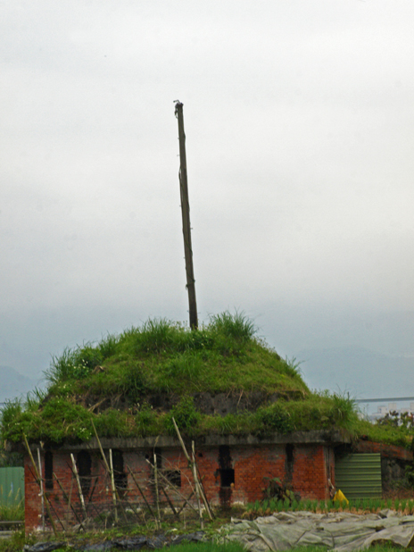
Scattered around the airfield perimeter are hardened aircraft shelters designed to be camouflaged with grass and trees. These were difficult to spot from the air. They still do a great job of blending in to the landscape as it took me a long time to find just a couple.
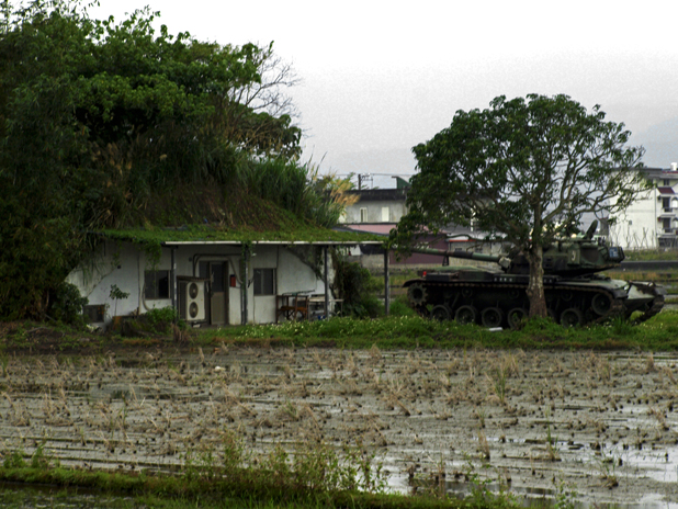
There were 14 of these shelters in all, and many of them survive. At least 4 are on the live side of the base.
During the war, students and locals were recruited to build fake bamboo and straw aircraft and place them on the “wrong” side of the airfield in an attempt to foil allied raiders. Many of these fake aircraft were constructed during the war.
Kamikaze sorties were flown throughout the pacific war, with the Kamikaze crews stationed in the dormitories of the agricultural college. The students were forced out and were required to sleep in the stadium of the college or build their own makeshift accommodation out of bamboo and other local materials.
Throughout the war, over 2, 500 pilots took off from this airfield towards allied fleets on suicide missions.
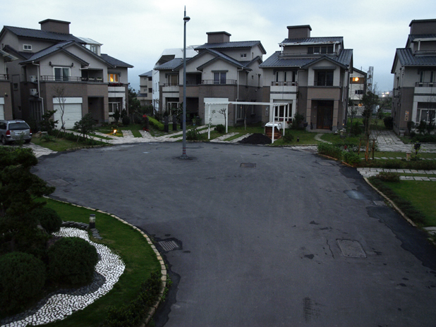
After the war, in 1945, the airfield was abandoned. However, the KMT were quick to get their hands on the airfield when they arrived in Taiwan. The airfield was little used, however, it continued its role as a weather station and as an emergency landing site. The airfield was given a paved runway which had a length of approximately 5000 feet which points north east to south west, and a new military complex was added to the south west. This is the military area still in use today. On the north east side of the airfield, there were (apparently) maintenance facilities and dispersal hardstandings - these are taxiways ending in concrete circles where aircraft are parked to effect rapid takeoff in the event of an attack.
There is evidence of the dispersal hardstandings still to be seen, and some of these now form part of the streets of a new housing complex. (see picture).
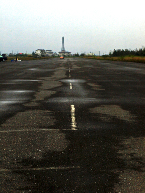
The runway is also still in existence, and most of it stands in a poor state of repair.
The airfield was later handed over to the Taiwanese navy. The navy stationed a PC-3 Orion aircraft at the airfield. This aircraft was used as an airborne early warning aircraft. Plans were made by the navy to expand the airfield and increase its capabilities, but this would mean that no planning permission would be granted on or near the area for buildings over a certain height, which annoyed the local government at the time. Also, residents were opposed to the noise extra air traffic would cause. The cost of running the airfield as it was, was unjustified without expansion as it was inefficient just to station one aircraft there. Because of the concern of residents and expense, attempts to increase the capacity and role of the airfield were abandoned.
The airfield eventually closed in 1973 before being abandoned by the military. A KMT soldiers village existed nearby until recently, but this has been demolished.
The airfield is still listed with ICAO as RCMS. It is listed as a visual navigation aid.
PICTURES:
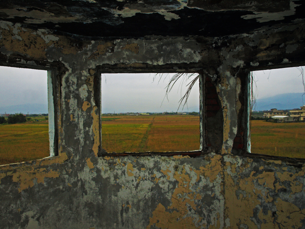
The control tower and view from within. Under the tower, there is an air raid shelter, although access to this is very difficult. As you can see, this structure has suffered from fire damage. One of the cupboards at the front served as a medical room, as inside there is evidence of bulk military medical supplies.
The runway, looking south west.
The meteorological observation station.
This is one of the hardened aircraft shelters on the live side of the base, complete with complementary tank. Note the lack of fencing.
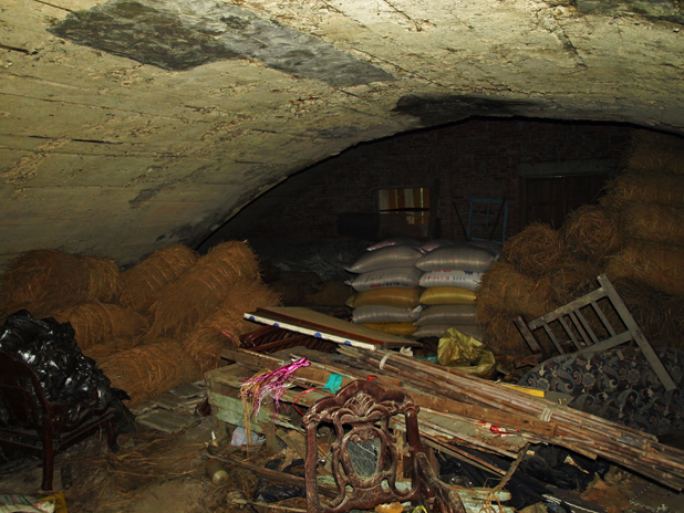
Another hardened shelter off-site, used by a farmer for storage.
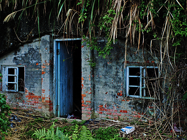
Inside the shelter, concrete reinforcements.
A dispersal hardstanding now being used as a cul-de-sac for housing development.
Boxes of flares and possibly ammo in one of the shelters on the live site.
If anyone has more information about this site, please add it here or contact me, especially if I am wrong about any of the information here.
Hope you found this interesting!!

 it’s probably been sitting there since about the last time they used that runway