Edit: I’ve answered my own question: Google maps, duh! ![]() Well, I’ll leave this up for future searchers.
Well, I’ll leave this up for future searchers.
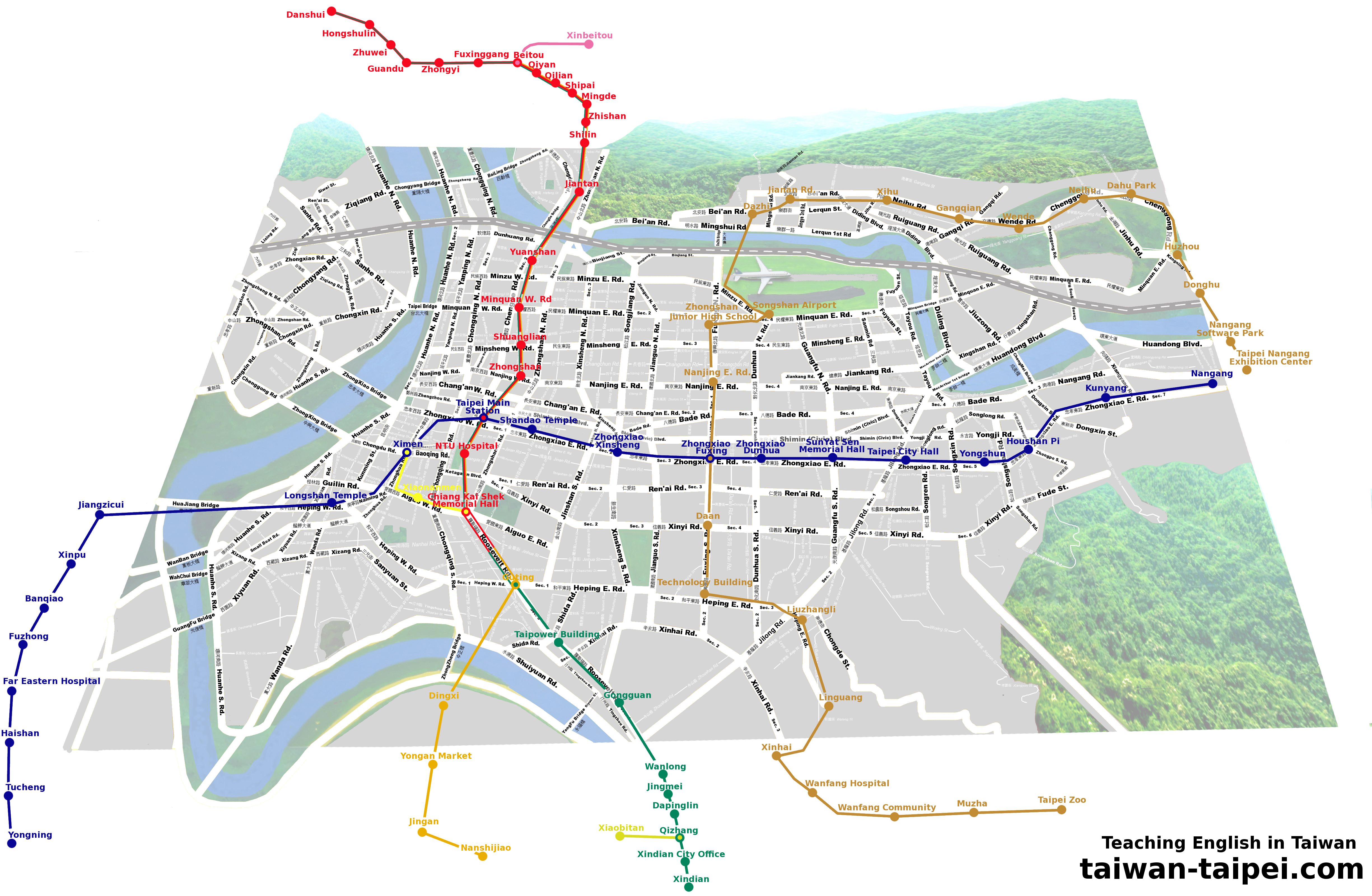
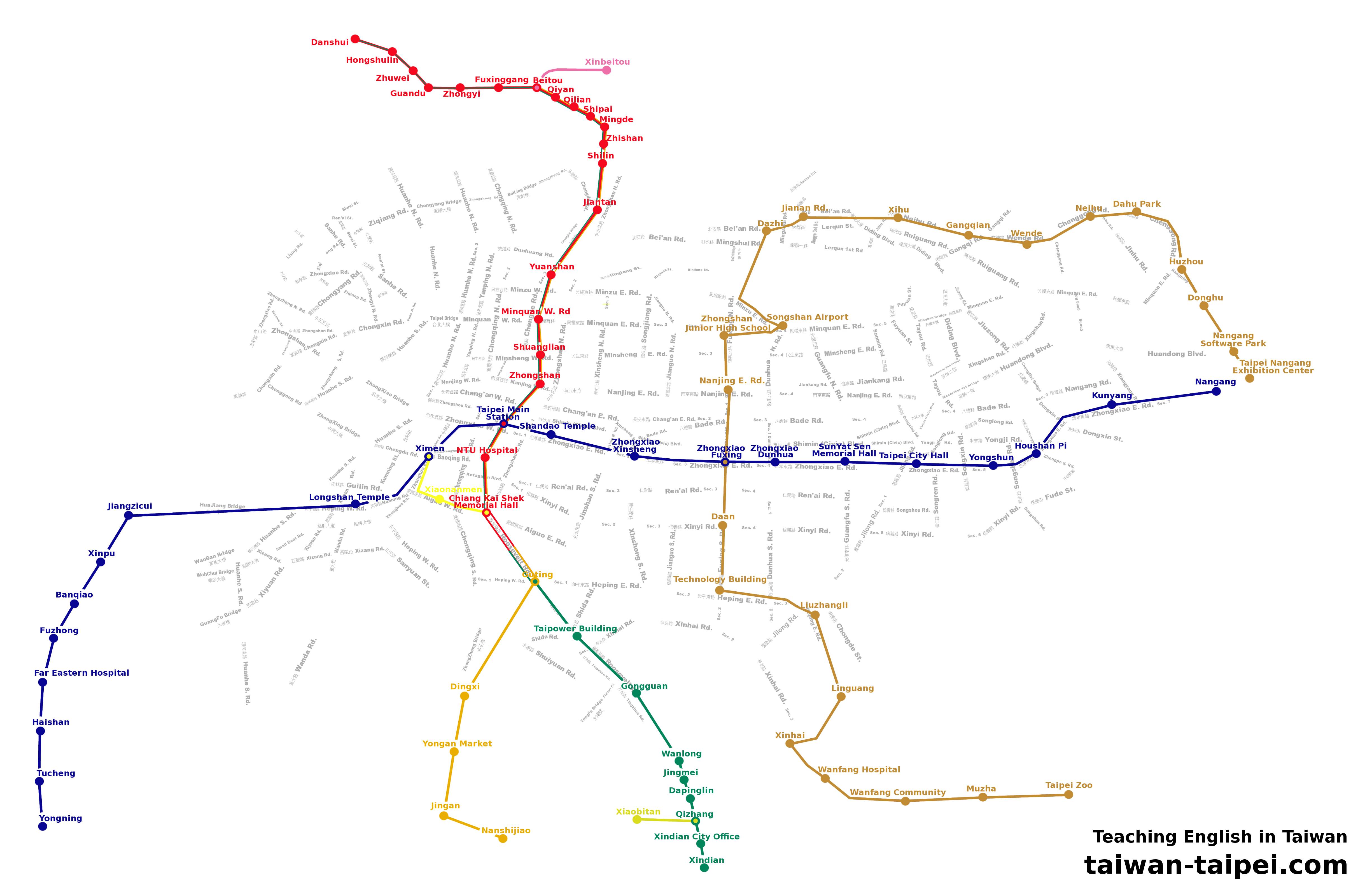
[quote=“Hamletintaiwan”]I made one just for you.
http://www.taiwan-taipei.com/grafx/taipei_MRT_map.jpg
http://www.taiwan-taipei.com/grafx/taipei-MRT.jpg[/quote]
It’s nice to see a map that gets the Pinyin right.  (Some of the names of bridges could stand a bit of work, though.)
[quote=“Hamletintaiwan”]I made one just for you.
http://www.taiwan-taipei.com/grafx/taipei_MRT_map.jpg
http://www.taiwan-taipei.com/grafx/taipei-MRT.jpg[/quote]
Nice!
Not to burst anyone’s bubble :aiyo: but you can get one of two really nice paper maps for free… both contain the information you’re looking for.
Taipei Tourist’s Map (in English)
Taipei Bicycle Routes Map (in English)
The bicycle one is SLIGHTLY prettier, but both are well printed and include all the MRT stops … well, except for Luzhou line, which I think is there but dotted as a “planned” line.
Not too shabby Hamlet, thanks! 
[quote=“JuliaZ”]Not to burst anyone’s bubble :aiyo: but you can get one of two really nice paper maps for free… both contain the information you’re looking for.
Taipei Tourist’s Map (in English)
Taipei Bicycle Routes Map (in English)
The bicycle one is SLIGHTLY prettier, but both are well printed and include all the MRT stops … well, except for Luzhou line, which I think is there but dotted as a “planned” line.[/quote]
Now that I’m here in my office, where the maps are:
Map of Taipei Riverside Bicycling, issued by the Taipei City Government, January 2010 - I got this one at Treasure Hill during the Daniel Pearl day of music
Taipei metro Tourist Map, issued by Taipei Rapid Transit Corporation, June 2009 - you can get this one at most big MRT station’s information kiosks by just asking for it
Hopefully one or both of them will be updated soon given the new MRT lines opening up. My money’s on the MRT map for an earlier update; it’s older, and there are more changes to its core content, but given that they are both free, either one of them can serve you pretty well if you’re willing to use a fold-up paper map.
That’s fantastic work Hamlet.
Did you do that yourself?
I like your street names (incl Chinese) behind the MRT stations
[quote=“JuliaZ”][quote=“JuliaZ”]Not to burst anyone’s bubble :aiyo: but you can get one of two really nice paper maps for free… both contain the information you’re looking for.
Taipei Tourist’s Map (in English)
Taipei Bicycle Routes Map (in English)
The bicycle one is SLIGHTLY prettier, but both are well printed and include all the MRT stops … well, except for Luzhou line, which I think is there but dotted as a “planned” line.[/quote]
Now that I’m here in my office, where the maps are:
Map of Taipei Riverside Bicycling, issued by the Taipei City Government, January 2010 - I got this one at Treasure Hill during the Daniel Pearl day of music
Taipei metro Tourist Map, issued by Taipei Rapid Transit Corporation, June 2009 - you can get this one at most big MRT station’s information kiosks by just asking for it
Hopefully one or both of them will be updated soon given the new MRT lines opening up. My money’s on the MRT map for an earlier update; it’s older, and there are more changes to its core content, but given that they are both free, either one of them can serve you pretty well if you’re willing to use a fold-up paper map. [/quote]
Yep, agree. That cycling map is one of the best city maps you can find. You can pick it up at the visitor centre in the Taipei main train station.