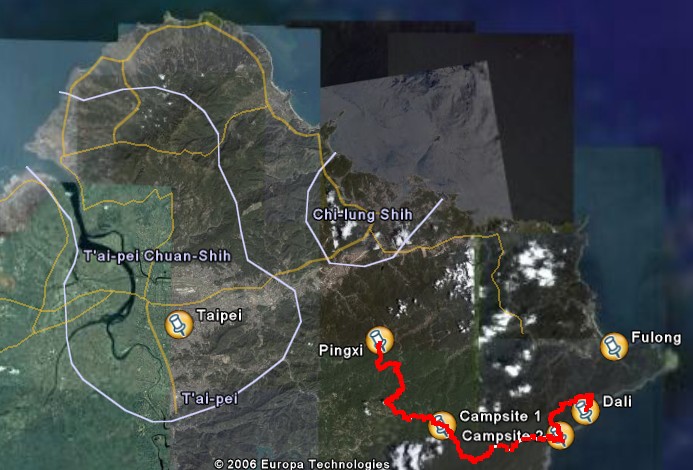
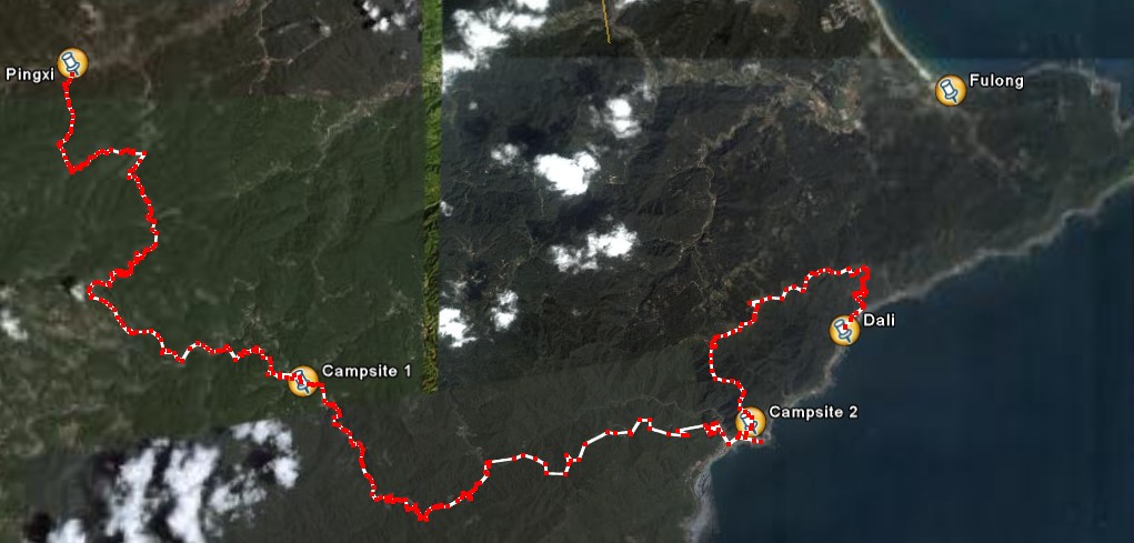
The North East Trail: this is the name Chris and I gave to the route we hiked over 4 days during the long Moon Festival weekend of 2006.
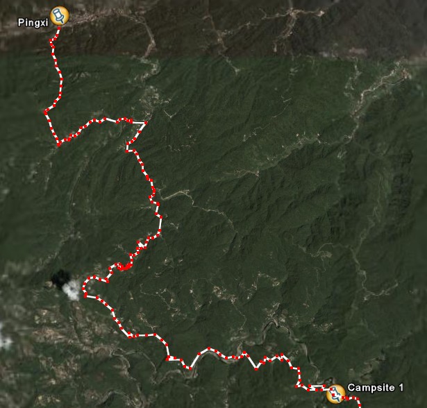
Day One: Pingxi - Pinglin
Day Two: Pinglin - Daxi
Day Three: Daxi - Fulong
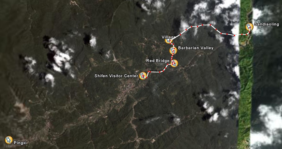
Day Four: Fulong - Shifen/Pingxi (with a short train ride from Fulong to Sandiaoling)
The journey was fun and we saw places that just beg for a return but overall I would not say this is something others would want to copy. At least not as we did it. Most days we far too long, leavign us no time to enjoy swimming holes and beaches. We just walked and walked and walked some more, then ate, chatted a bit, took some notes, and went to sleep.
I’ll just begin with some photos and add more commentary (and proofreading, forgive the spelling errors) later:
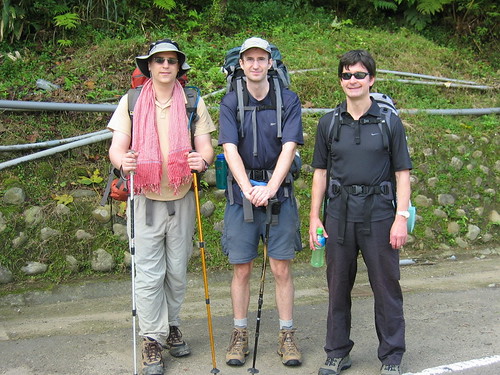
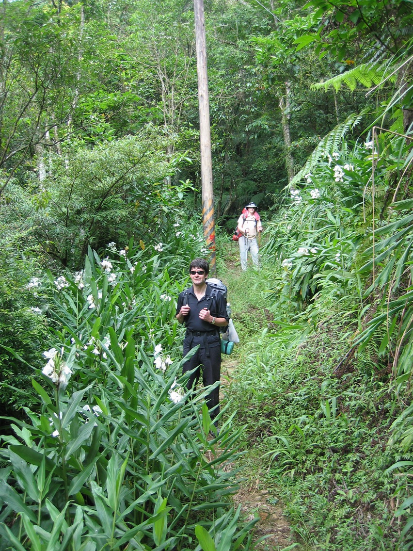
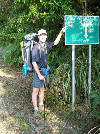
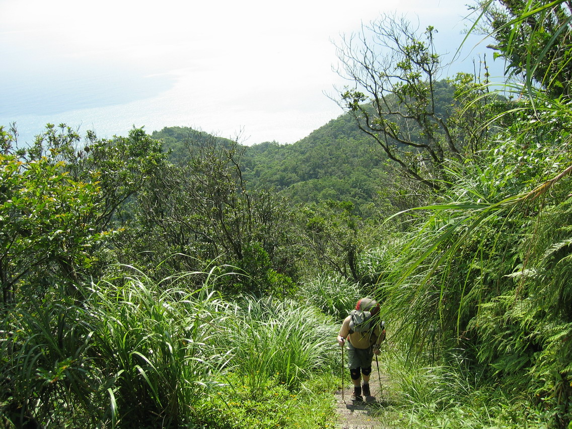
Three men began:
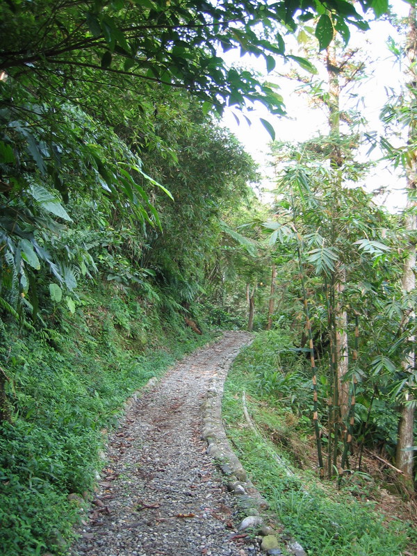
The trail was clear and wide at the start.
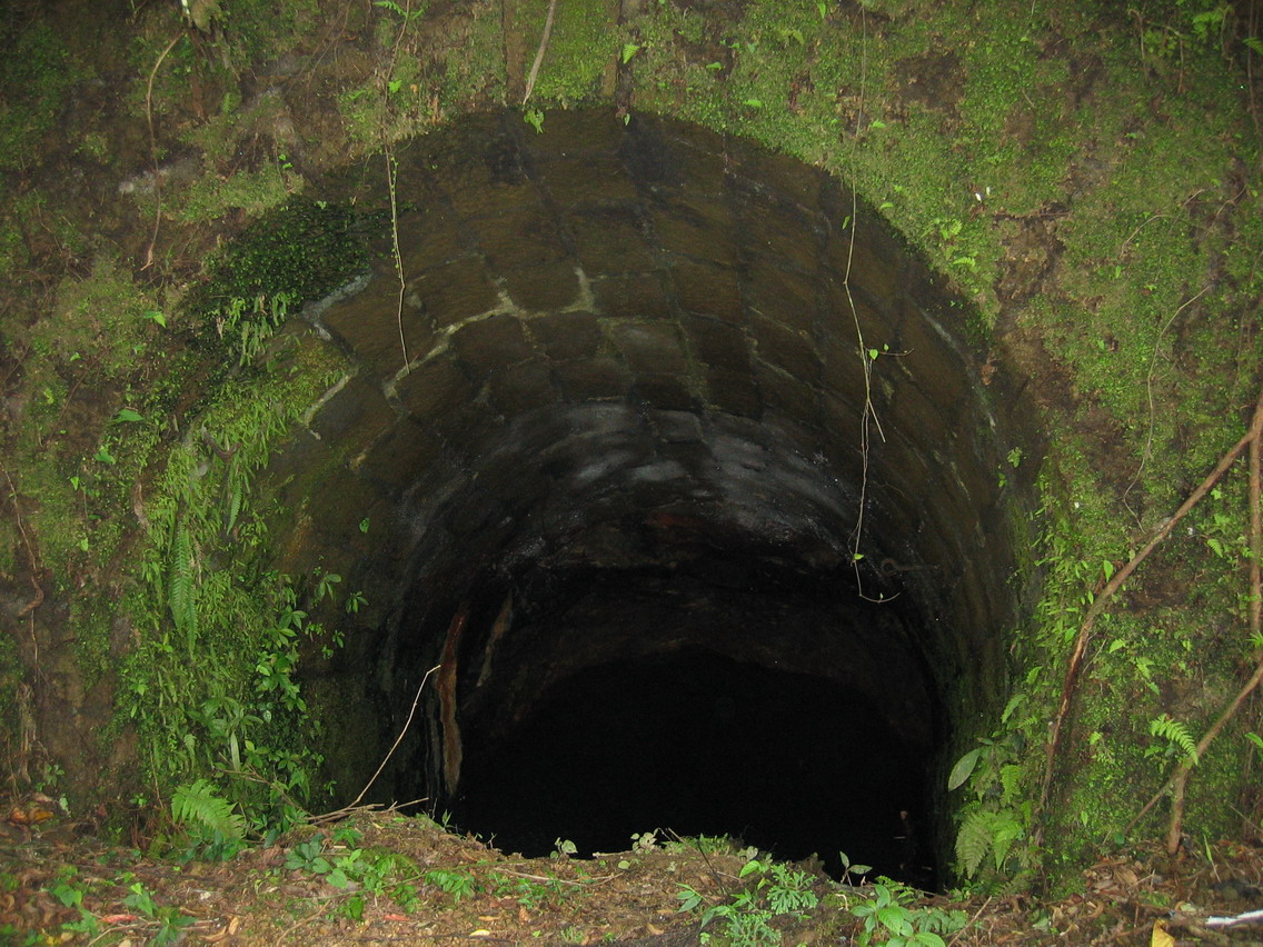
Gollum’s Lair:
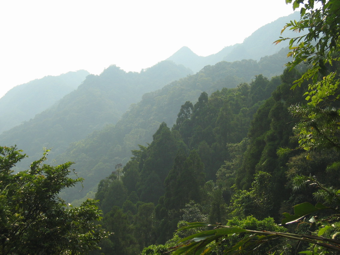
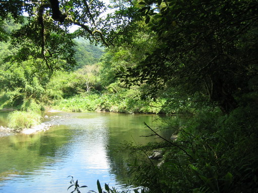
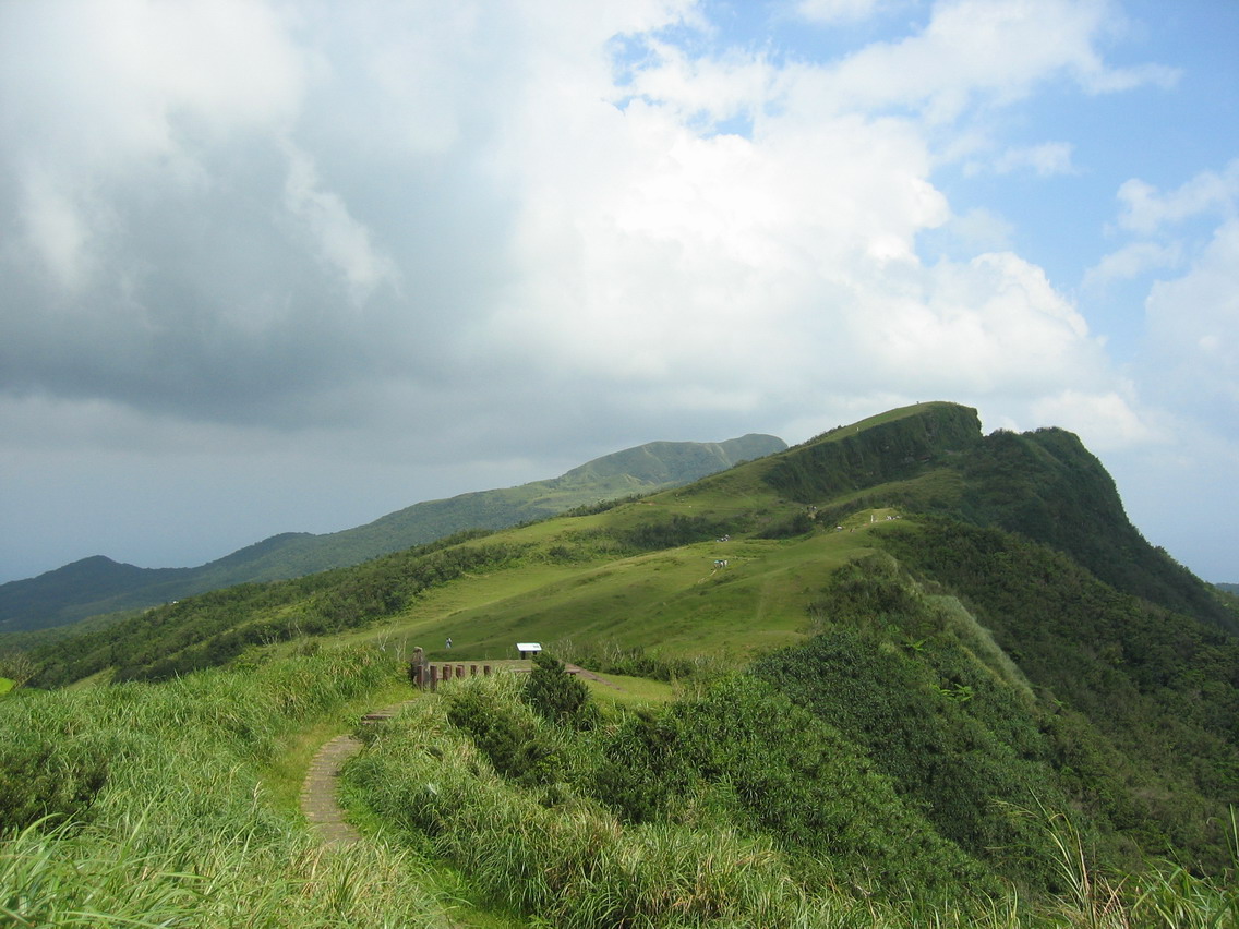
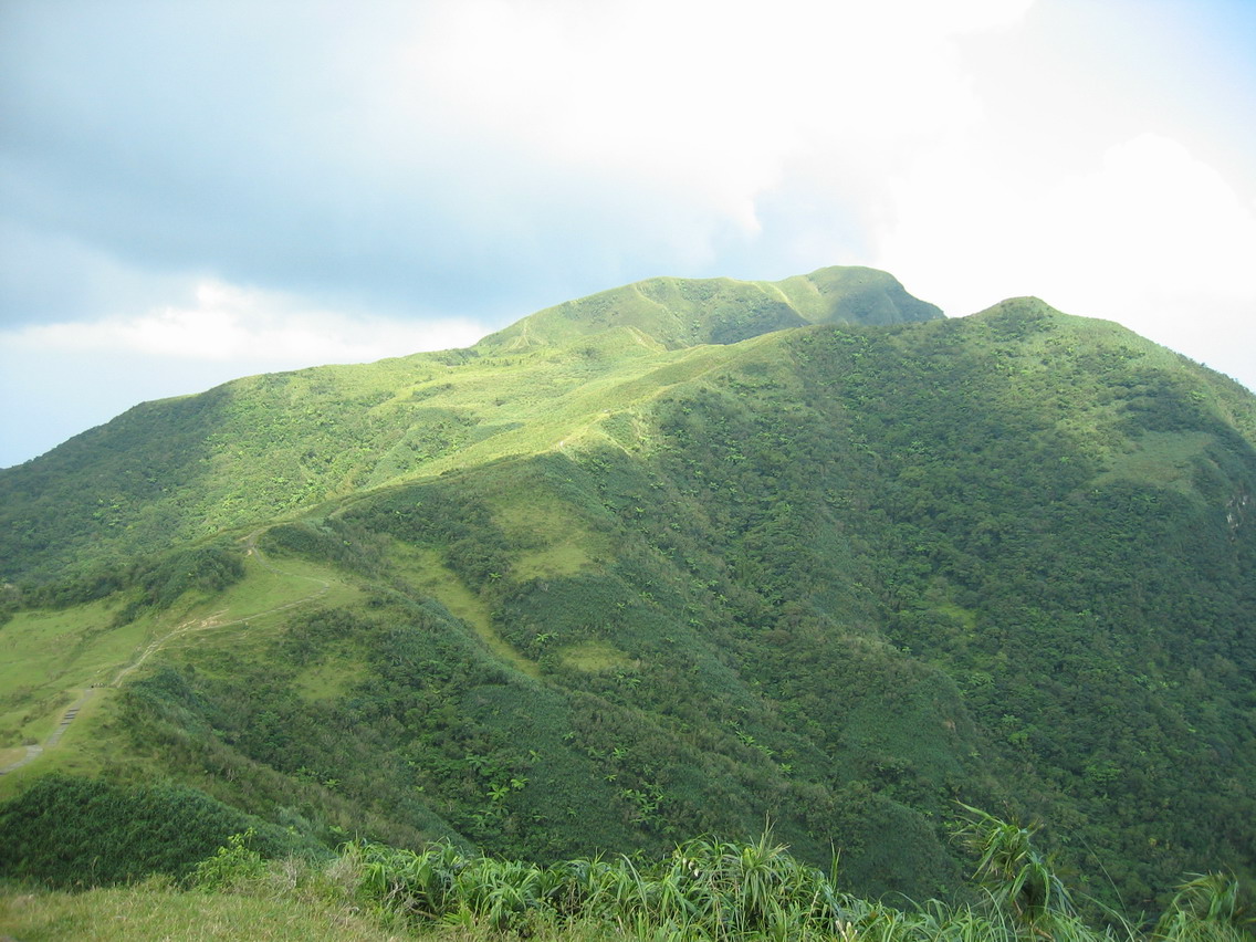
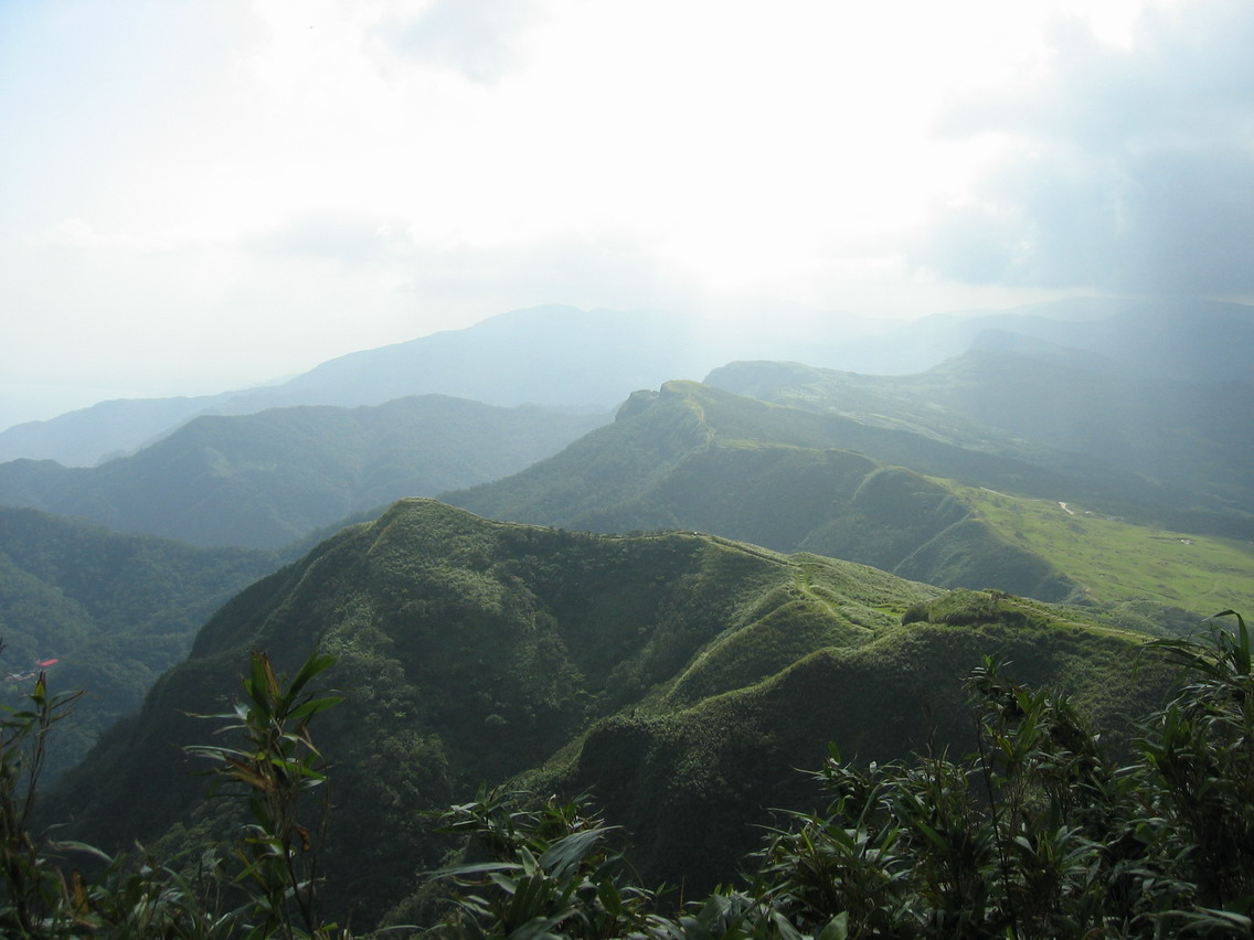
Lovely scenery:


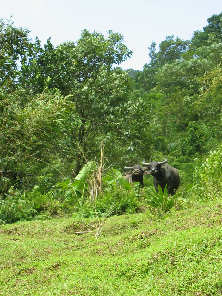
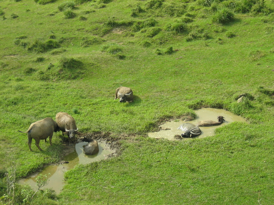
Pissed off water buffalo:
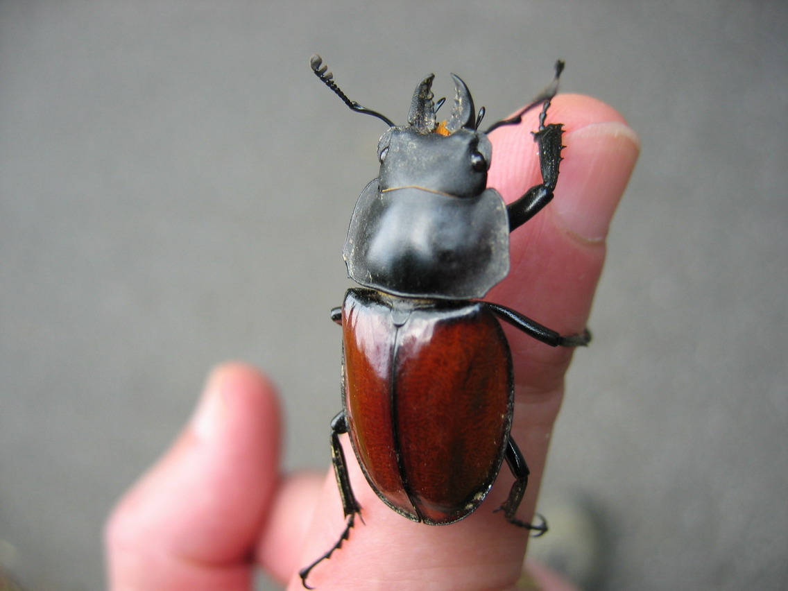
Lots of insect life:
Wild ginger grew everywhere filling the air with it sweet perfume.
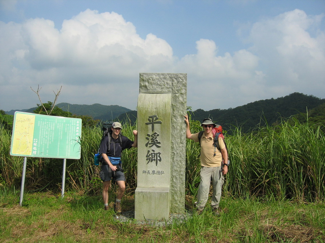
After two and a half hours on the trail we reached the road. We followed that for another hour to the Pingxi-Pinglin County border. This was one of my favorite spots on the whole trip. There’s a peaceful stillness to the spot despite the wind and rustling of tea leaves and elephant grasses. It’s as if you can hear more clearly hear and feel more acutely. I’ve been here several times and I always get the same feeling of a magical heightening of the senses.
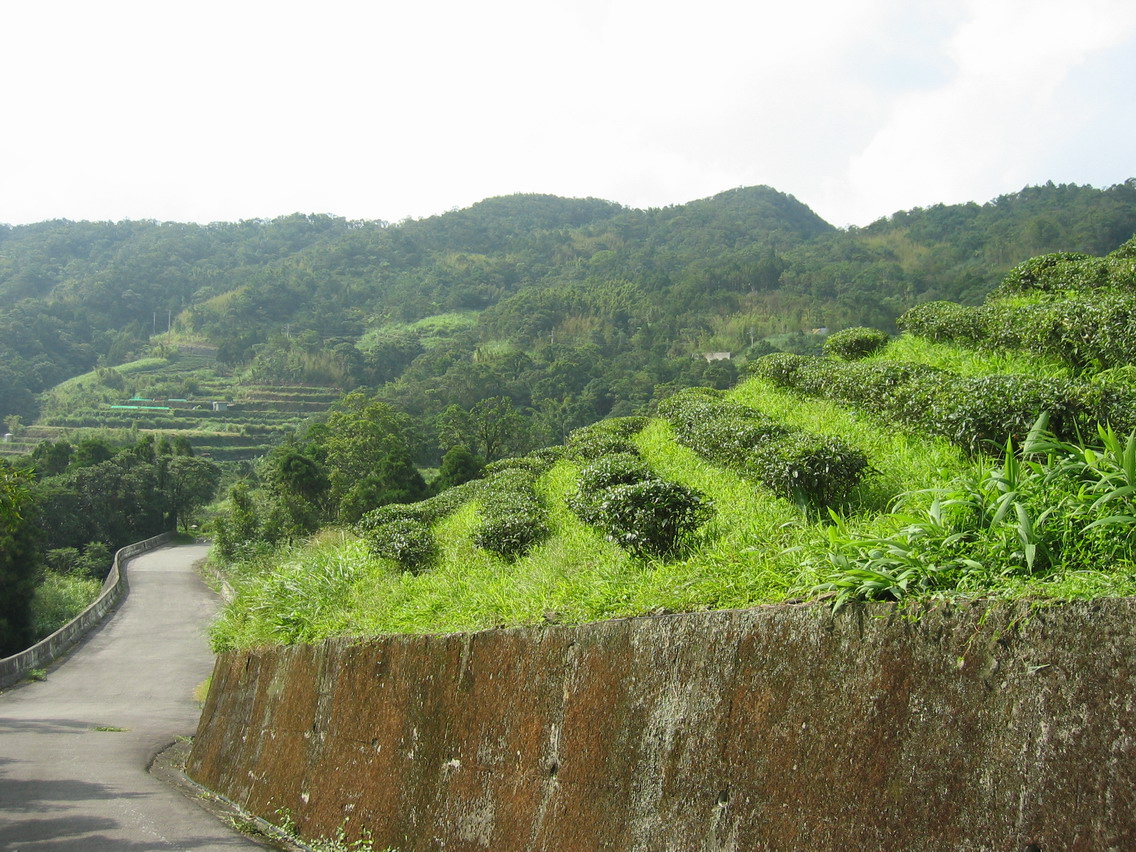
We walked down the steep road to Pinglin, passing old farmhouses, and verdant fields of tea trees, and fortunately, avoided getting roped in to a family bbq. Whew! Omni had the good sense to say we had already eaten. No arguing with that in Taiwan.
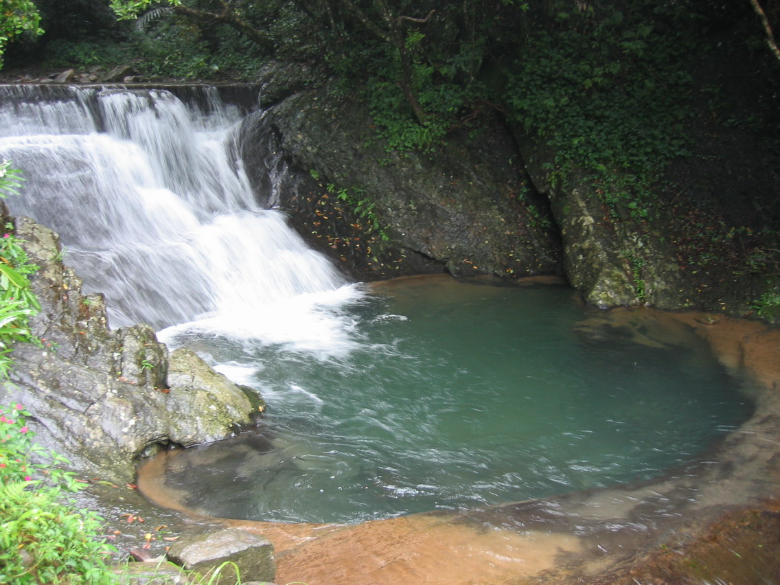
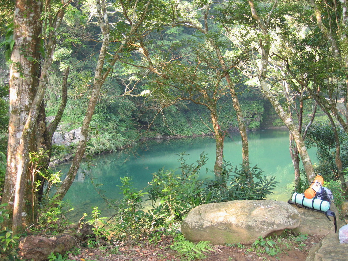
Lovely swimming hole before we reached the first campsites.

Now we should have stayed the night in the first campsite by the river but we felt our reserves of energy were on high and we should go as far as Heilongtan. Not the best decision as it took almost an hour and a half to reach Heilongtan campground, and the walk was up the steepest road we had encountered yet. We arrived at our camping spot at twilight, delayed only slightly by stopping at the camping store for a couple beer.
The campsite was mostly full, and we had been warned by Mr He to avoid the main grounds as a group of gangsters holds loud parties all night in one of the cabins. So we carried on down the road to the point where the Wantan and Beihsi Rivers join.
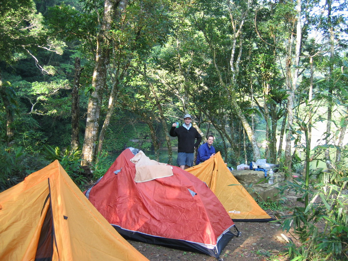
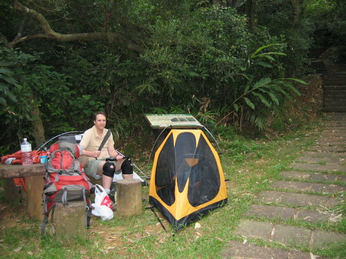
We were lucky and found a site on this little knoll beside the river. It had a bit of garbage on it from the previous campers, but we cleaned it up quickly and set up our tents. Omni and Chris went for a swim in the massive swimming spot behind us while I tried to get my gas lantern to work. Damn thing never gave off more than a candle watt of light.
First days hike: saw bamboo forests, cedar forests, day lilies, wild ginger, 4 water buffalo, blue magpies, and a DEER!
Day One start: 9:15. Arrived in Heilongtan 6pm.
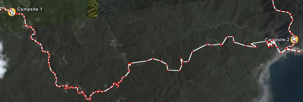
Day Two:
Woke up early and had breakfast. Omni needed to help his wife with translation work later in the day so he headed off back to Pinglin.
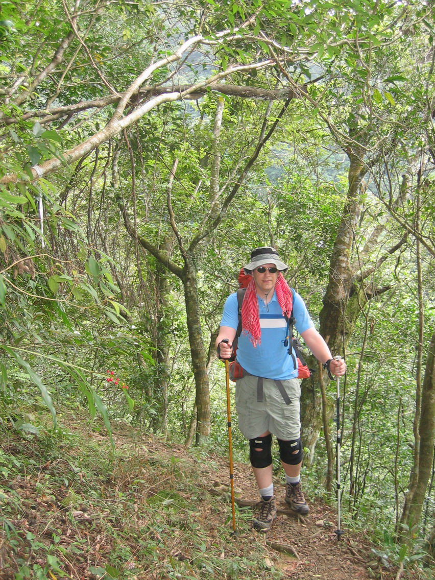
Chris and I continued:
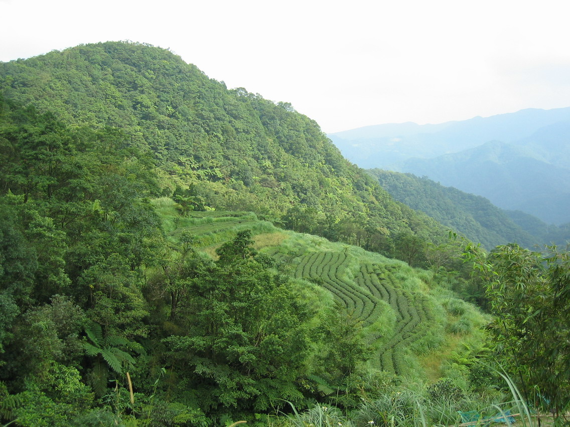
From our campsite, we headed east on a good trail above the Wantan River.
Gorgeous area. One of the best places I’ve seen for camping out. There’s a big open grassy area (kept low by grazing buffalo) about halfway down the trail (1.5 hours) perfect for pitching a tent on, on and a small beach area as well that would also serve as a magnificent base. Several pristine deep swimming holes nearby, and if you camp on the beach, well, one if right there in front of you. In fact, I can’t remember seeing a river with so many prime swimming holes. This will surely be one of the hiking club’s new hangouts next summer.

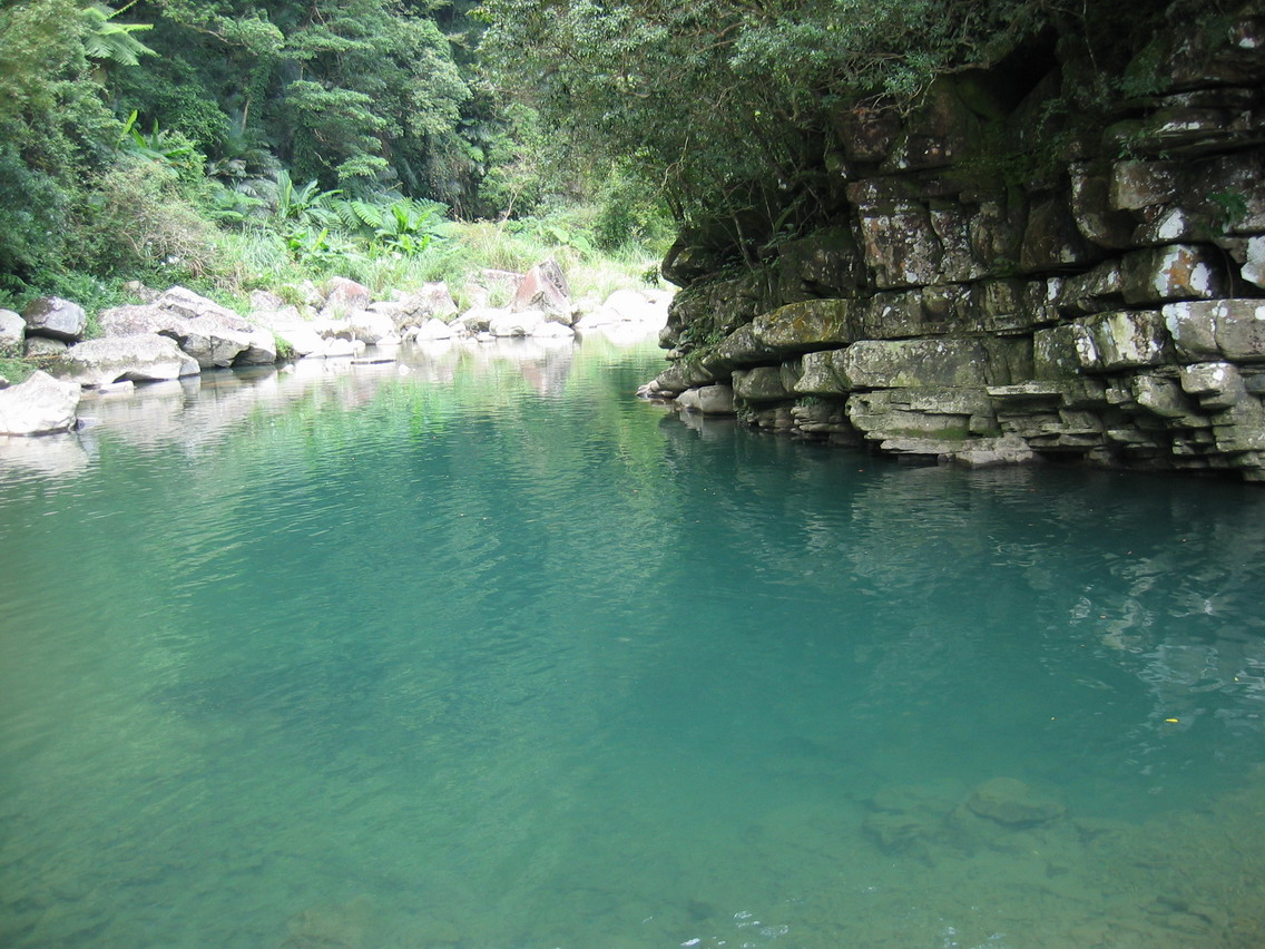
The last section of the trail before Wantan runs right alongside the river. It’s a picnicker’s dreamscape.
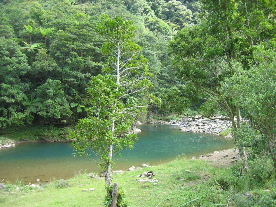
3.5 hours after leaving our morning camp we reached Wantan, which is not a village but simply a campground and a few houses (which explains why the river is still so clean).
There was no water for sale at the camp store though the family picnicking nearby gave us a couple small bottles. We never did figure out if we had our lunch in someone’s front yard or in the campground.
By the end of lunch I was out of water and should have filled up in the bathrooms but I thought there would be streams along the way. Also, the women in the campground were starting to give us too much attention. It was time to go.
From here on in it was all road walking until we reached Daxi beach. But it was very pleasant, in fact extremely pleasant, as there was almost no traffic, the sides of the roads were covered in flowering plants, and there were lovely views from the road.

We had one rather unpleasant experience, I have to say, which involved water.

The decision not to get water at Wantan was foolish as we were not able to find a stream we could access for a long time. All the streams we encountered, and there were many, flowed under bridges and had impossible to descend slopes.
Finally, though we found a cement path down to a side stream. We treaded carefully down the slippery surface to the small clearl looking stream and used our water filter to fill our water bottles up. When mine was full I took a big sip (maybe 200ml) and then topped the bottle off again.
We set out back on the road and a 100 metres later came round a bend and saw a chicken farm. It’s filthy, green, slime ridden trench for runoff and waste lead straight down into the stream we had just taken our water from: the water I had taken a large drink of.
Oh wretched fate to have played so cruel a trick on us. I felt as green as the sludge below me. We emptied our bottles out of course and I cursed my luck. But as luck would have it, I did not get sick at all. Omni, you can rest assured that those filters really work. (Or I have a steel stomach.)
Fortunately, we did find a nice spring a while later.
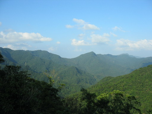
We reached the main road down to Daxi in 2 hours. After a few kilometres up and down we began the long descent to Daxi beach. The views from the road were dramatic. I was thankful every moment that we had clear dry skies. I have driven along this road many times and it can be spectacular on days like this, or merely interesting when there is a mist.
This road is Bond, James Bond:
Now this second day proved very long. It was 3.5 hours to Wantan then another 1.5 to the road down to Daxi. It was a further hour to reach the 10 km mark, meaning there was 10 km to Daxi itself. My feet were sore, I was worried about getting sick, and more than a little disapointed that our schedule meant we could not stop for a swim in the Daxi River or the ocean. Taiwan really needs daylight savings time.
Around the 5 km mark we accepted a ride to Daxi. It was getting late and well, it was the right thing to do. Our hosts were a group or Taiwanese hikers or daytrippers. There were seven of them already in the van but they let us squeeze in. The ladies just hopped over the seat and squeezed into the back.
It was now 5:30 and we had been on the road since 9:15. Our hosts dropped us off where the 007 hits the highway. They were going to take us to the fish market but traffice was backed up going north and they lived in Jiashi.
We thanked them and got out. I must say that I appreciated the traffice jam as it meant we were in no danger walking along the highway: we moved as fast as the cars. Which must have been pretty slow as we were exhausted. Slowly, we wended our way to the fish market. I didn’t like treading through the market with my pack on as we had to walk along the edge of the harbor. With an overweighted pack it would have been easy to to knocked into the styrofoam sea (I guess there was some water there too but I could hardly see it).
We bought two mid-sized fish froma pretty young fishmonger, made a few comments how Omni should have been here, and then treaded back carefully again out of the market and across the highway to a seafood restaurant. We waited what seemed half an hour for someone to take our order (we were standing up outside the whole time, feet aching, bodies drenched in sweet). We agreed on steamed fish and a number of side dishes. Our waiter proceeded to forget half our side orders and the cook steam our fish until it was as hard as rubber. Bastards!
It was now around 8pm and though Chris and I had had a big (if unsatifying) dinner and a few beer, we had no where to stay. There’s a campground on the other side of town, as far away from the next morning’s trailhead as possible, but we coudl not bear the thought of walking such a distance only to have to retrace our footsteps in the morning.
So instead we chose to hike up the Caoling Trail until we reached a pavilion or site where we could set up our tents. It was slow going up the stone steps, and I could feel Chris cursing me behind my back, but 20 minutes later we found a good clear, flat spot in a bamboo grove and set up camp. There was little chatting that night before turnign in to sleep.
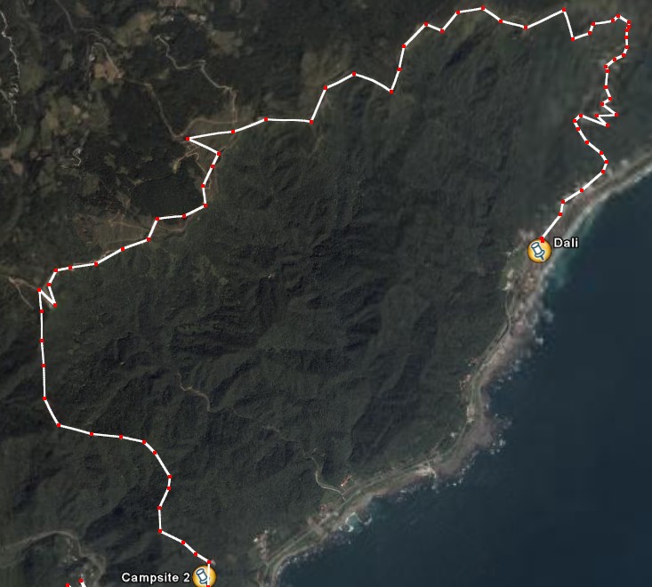
Day Three:
We got up around 6am this morning, and got a very early start on the hike. This was fortunate as this was to be the longest and most difficult day. It also grew warm and then hot very early. In fact it turned out to be the hottest day. But there was no complainign about the scenery. This still remains one of my favorite hikes in the north, even if it is all stoned.
The stunning Taoyuan Valley area. When we reached here we had just run out of water (after hiking 3-4 hours). Fortunately there was a bathroom with running water. An earlier bathroom had had flush toilets but no runnign drinking water. And no I was not about to test the limits of my water filter on that.
The bathrooms also affored the only shade. Taoyuan Valley is not a valley at all but a grassy bluff overlooking the Pacific. It’s a splendid area to rest on a cool day but on a scorcher like the third day of our hike it was far less pleasant than it could have been.
Chris and I hung out outside the bathrooms for as long as it was decent, and then headed up to the bluffs for lunch. We found a cool spot on a lonely rocky knoll and set up our backpacks and unbrellas on the rocks to provide shade. It worked and we were able to stretch out and relax for at least 15 minutes. For then a group of dull-witted, greasy faced, plastic bag toting obasan grunted there way up to our little knoll, ignoring of course the other dozen or more knolls nearby, to say notrhing of the vast even slope to our left (because of course that was desereted which meant it was no good), and chatted on like resting hippos about the water, grass, and mosquitoes. I tossed a few bread crumbs over my umbrella at them but they seemed to take this as encouragement. Fortunately, the hippo patriach, far away on the higher bluffs, bellowed out for the herd to return after a few minutes and they did, dutifully, if not beautifully.
Turtle Island in the mist.

Buffalo wallowing:
Now on this the third day, we had started out at 8 o clock in the morning. We arrived at the Dali-Fulong junction at 4:30 and ran into Snafu and travelgal by coincidence. It was good to see some friendly faces but it didn’t help with the feelings of utter exhaustion. The heat of the day, and our weighty packs had really slowed us down. The Caoling Trail is almost all stairs, up and down, all the way. Without packs it had taken us 6 hours before as a group. But that was also starting at the trailhead a few kilometres outside Fulong.
Fromwhere we were now, it was 2.8km to Dali and 6.9 to Fulong. We chose to go to Dali and take a train the rest of the way to Fulong. I’m glad we did, not just as it was obviously the easier route, but because there is a gorgeous temple in Dali I have never seen before. Anyone contemplating the Caoling Trail I recommend starting at the trailhead outside Fulong, hiking up to Taoyuan Valley then turning around and at the junction heading down to Dali.
Now, at this point we had been mostly out in nature for 3 days. Though we had been picking up garbage along the trails, and even along the roads, we had been blessed with some splendid scenery and mainly clean conditions.
It was shocking to my system, then, to exit the well-maintained and scenically outstanding Caoling trail, walk through the manicured grounds of the Dali temple, with its well-preserved traditional architecture, down the manicured road of the visitor centre with its dreamy views across the Pacific, to the highway, and onto the highway itself. Suddenly, Taiwanese traffic, noise, smells, and local shanties struck me in a way I did not expect. I recoiled from the ugliness and squalor and the assault on the senses, though there was nothing to do but try to steel myself to it. Hey, I had survided chicken-shit water, I could survived this. But still, walking down the road from the visitor centre I said to Chris, “If all of Taiwan looked like this, the tourists would flock in like it was Hawaii.” So sad.
Anyway, we caught a bus to Fulong where Chris’s wife was waiting for us. Our greetings were tepid to say the least. Then we dragged our weary frames to the Longmen campground and set up. I was impressed with the campground. Clean, green, well-organized, with some nice open views of the nearby mountains. Expensive though.
We had dinner that night at the wonderful seafood restaurant by the temple on Fulong Beach. Interestingly, we had the same fish as the night before but this time it was done right and melted in our mouths.
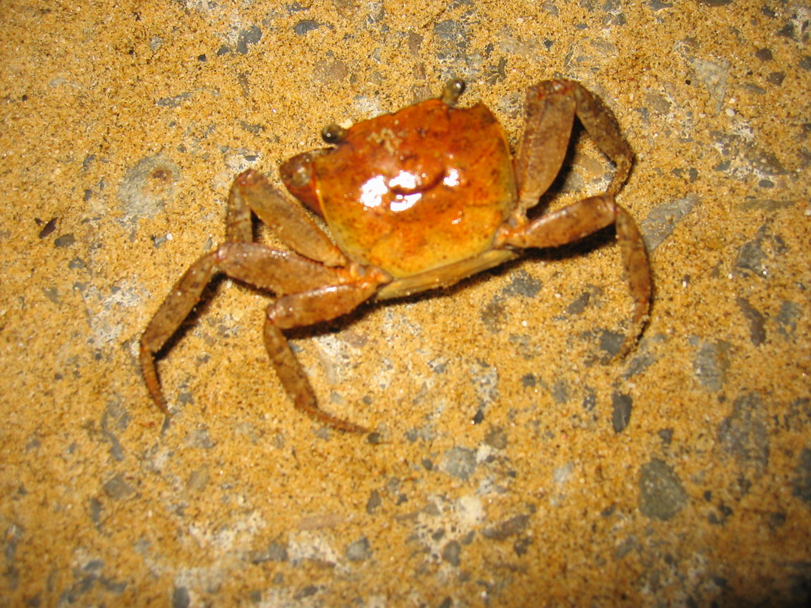
Happy Fulong crab:
That night we talked over the last day’s plan. Chris was visibly exhausted and had a massive blister on his foot. I felt that since the route was never going to be followed by hoardes of adoring Lonely Planet readers there was no need to finish it off. I have done the Sandiaoling waterfall trail many times so why do it again when i was so tired?
We decided then to call it a trip.
An interesting side note is that of all the places to camp we set up just 100 feet from another group of foreigners. Didn’t know it until they stumbled back in around midnight. Fine group of westerners they were. Bright too:
Girl: You cut my rope.
Guy: Yeah, we need a couple feet.
Girl: But my rope needs to be 13 feet long.
Guy: Yeah but we needed a couple feet.
Girl: But now it’s only 10 feet long. It’s no good.
Guy: Yeah but we needed a couple feet. What was I supposed to do?
Girl: Why didn’t you ask me?
Guy: You weren’t around?
Girl: Yeah but now my rope is useless.
Guy. What was I supposed to do? We needed some rope.
Girl: But it’s my rope.
Yadda, yadda yadda. In the end the conversation petered out. Guy never did apologize for cutting the rope and girl never did assert herself.
Day Four:
I couldn’t call it a trip. I had to finish what I had set out to do. But I would make it a little easier for myself by giving Chris and Kitty the bulk of my gear to carry back to Taipei for me.
We walked back to the train station and had a Fulong biandong. It was pretty good, but then again, I had drank chicken shit water and rubber fish.
We took the 11:49 train to Taipei and I got off at Sandiaoling. Interestingly, the waterfall trail was not as pleasant as the section afterwards which passed through bamboo forests. Too much debris is coming up from the ground along the trail where people long ago must have built retaining walls. I need to go there one day with a knife and cut a lot of that crap off.
For pics of this trail see:
forumosa.com/taiwan/viewtopi … 602#506602
Anyway, I finished the trail in 3.5 hours which surprised me as we usually took 5-6 hours as a group. Damn, we move slow together. No wonder Omni chomps at the bit so much.
Good to see that the slope of rubbish we had seen last time when we reached the bridge had either been cleaned up or completely washed into the Keelung (Jilong) and been carried away (hmm, I guess the second option is not a good thing). Also interesting to see that the bastards at Shifen Waterfall have built an ugly wall to block any view of the fall from the tracks. They also seemed to be building ramps that would allow people inside to walk above the people on the tracks. Deliberate? Do they really think their exorbinant entrance fee wil be more palatable o people if they can lord it over those who are outside the perimetre?
I passed by the falls area, and made it to the Shifen Scenic Area Visitor Centre. Sweaty and dirty, with a big pack on my back, I got a lot of funny stares. I went up to the top deck and ordered a coffee as I waited for my wife to come pick me up. From the deck I could see Wufenshan, the scene of the hiking club’s first hike almost 2 years ago. Overall, it was a great place to end a hike that I won’t soon forget, even if I have no plans ever to do it again.
I want to thank Chris and Omni for their companionship. It would not have been the same without you guys. I hope we can travel together on many more such journeys in the years to come.
PS this post was brought to you by Boddingtons Pub Ale.

 [/quote]